


Hochwilde
Fotografie našich používateľov

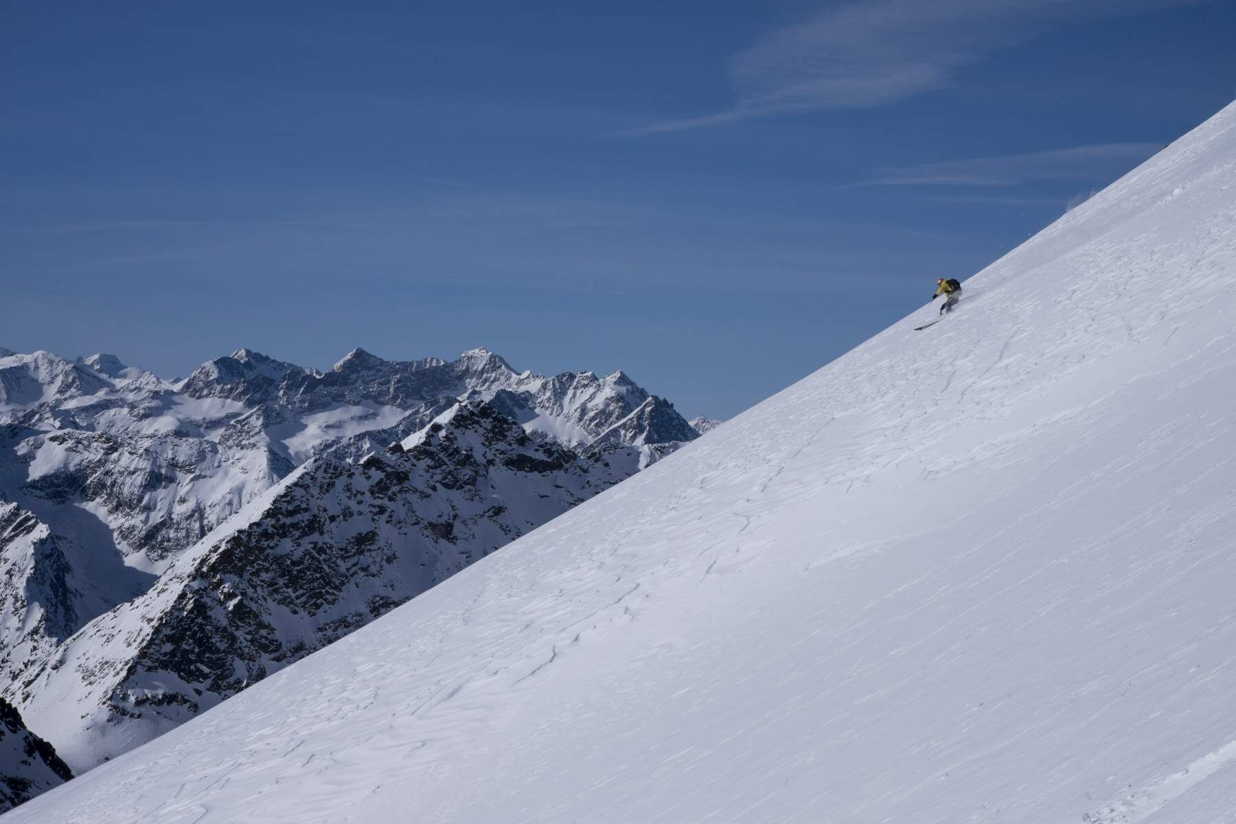
From the Langtalereckhütte through the Langtal in tight switchbacks very steeply up to the Gurgler Ferner (Annajoch) and then a few meters shortly, again very steeply, to the rocky summit formation of...
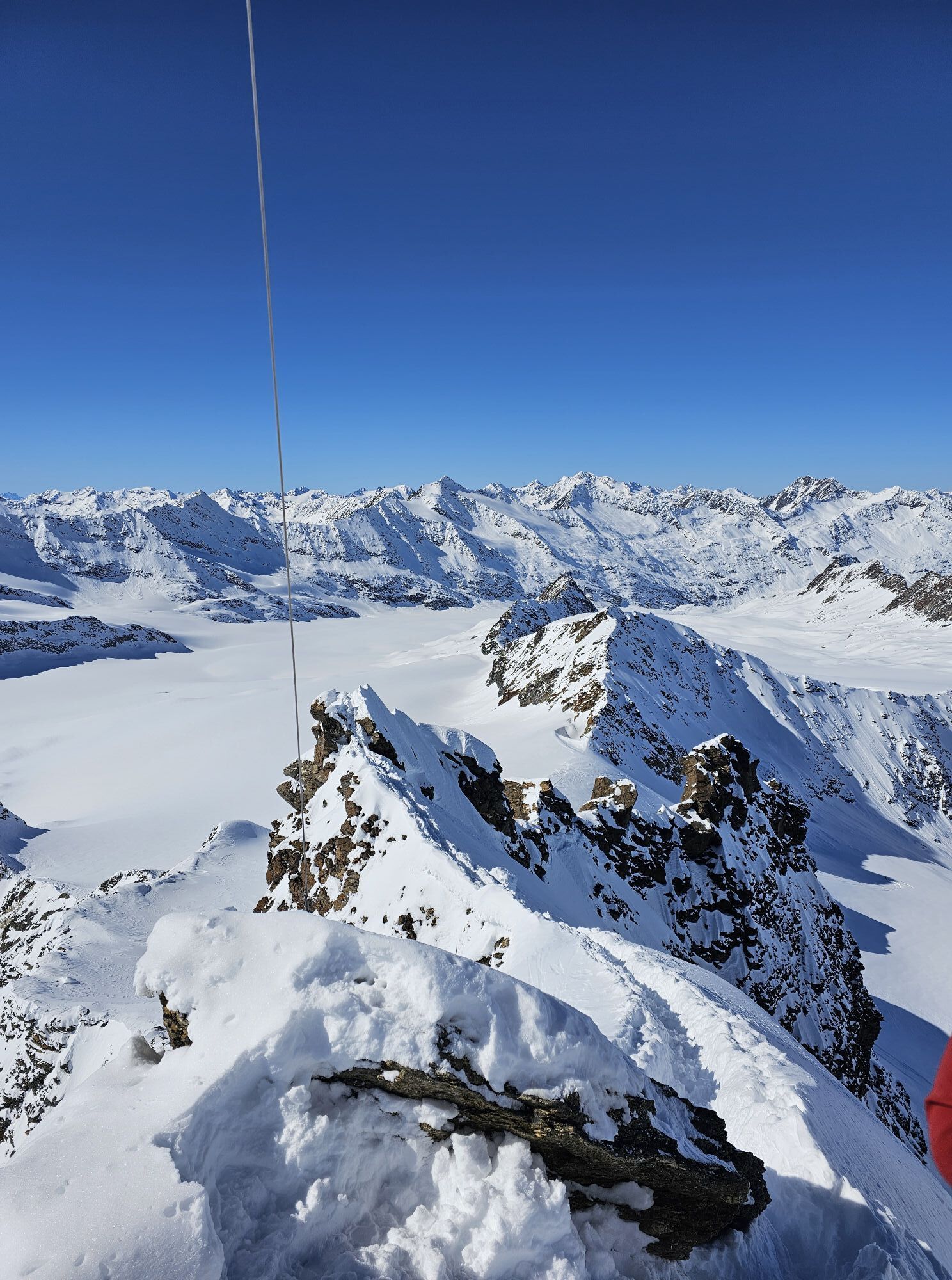
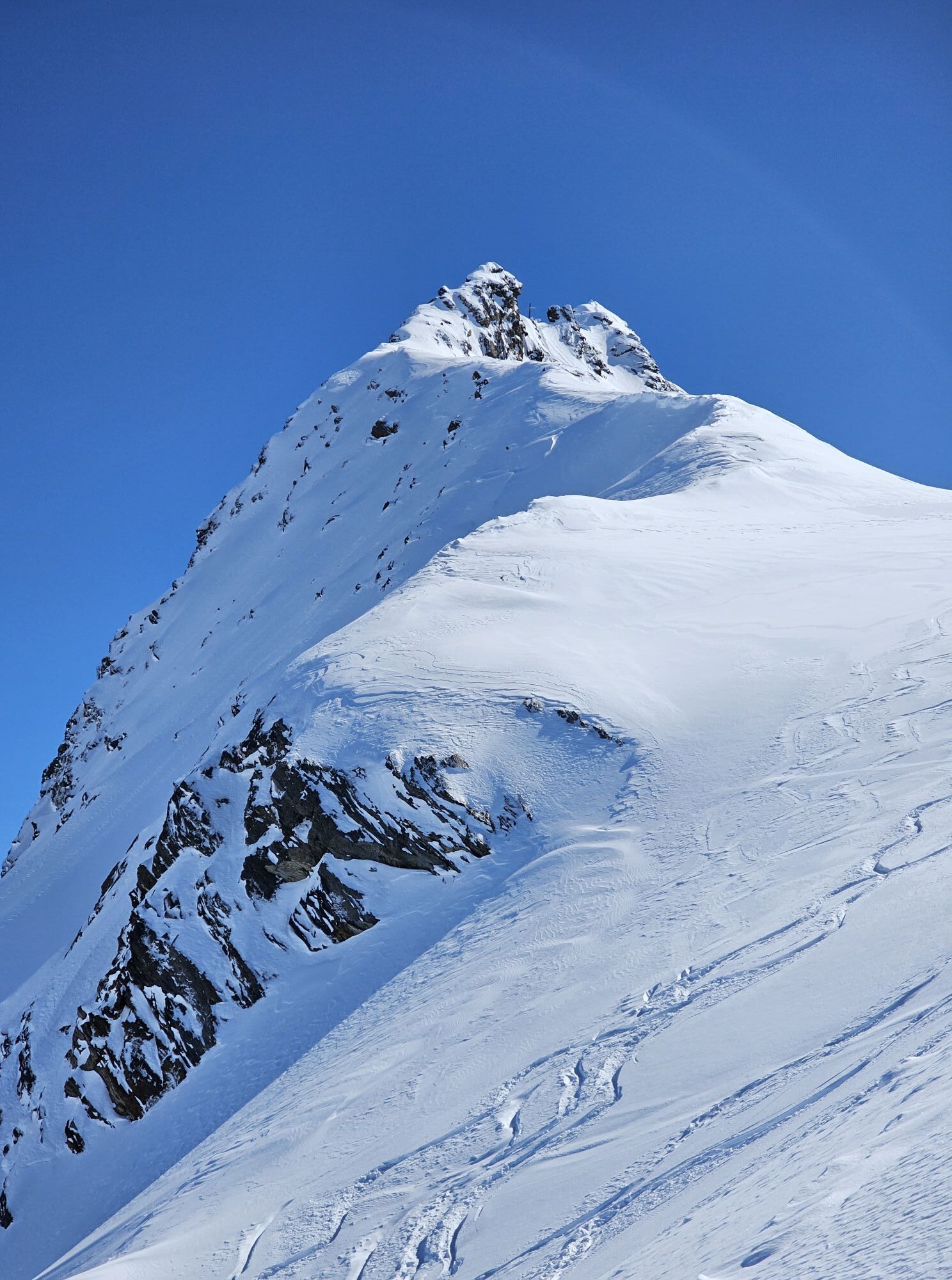
From the Langtalereckhütte through the Langtal in tight switchbacks very steeply up to the Gurgler Ferner (Annajoch) and then a few meters shortly, again very steeply, to the rocky summit formation of the Hochwilde north summit. Here from the ski deposit on foot through the steep gully, briefly crossing a rock head and the eastern steep flank. At the end over a narrow snow ridge to the summit.


From the Langtalereckhütte through the Langtal in tight switchbacks very steeply up to the Gurgler Ferner (Annajoch) and then a few meters shortly, again very steeply, to the rocky summit formation of the Hochwilde north summit. Here from the ski deposit on foot through the steep gully, briefly crossing a rock head and the eastern steep flank. At the end over a narrow snow ridge to the summit.
Recommended Ski Tour Equipment
The "normal ski touring equipment" consists of touring skis with touring bindings, telescopic poles, climbing skins, crampons, digital avalanche transceiver, avalanche shovel, avalanche probe, first aid kit, and a mobile phone. A "complete glacier equipment" consists of a harness, two differently sized Prusik loops or ascenders, two HMS carabiners, an ice axe, crampons, and a rope. A backpack with the appropriate contents should be carried, also including spare clothing, sun protection, cold protection, food, and enough to drink! For overnight stays in huts, do not forget to bring hygiene articles and a hut sleeping bag!
DIFFICULTY RATING
Easy: Easy, short to moderately long tours with ascents that do not exceed or only briefly exceed 25°. Medium: Medium difficulty, moderately long to long tours with ascents that do not exceed or only briefly exceed 35°. Hard: Difficult, long to very long tours with ascents reaching 40° or more, and climbing sections up to grade II difficulty (UIAA).Avalanche Danger Scale
1 (LOW)
An avalanche release is only possible with a significant additional load on very few, extreme steep slopes. No spontaneous avalanches (so-called slides) are expected. Generally safe conditions.
2 (MODERATE)
An avalanche release is likely with a significant additional load mainly on the indicated steep slopes. Larger avalanches are not expected. The snowpack is generally well consolidated except on some steep slopes. Careful route choice is advised at the indicated steep slopes and slope aspects.
3 (CONSIDERABLE)
An avalanche release is already likely with a small additional load mainly on the indicated steep slopes. Occasionally some medium, but also large avalanches are possible spontaneously. The snowpack on many steep slopes is only moderately to weakly consolidated. Experience in avalanche assessment is necessary. Avoid the indicated steep slopes and slope aspects as much as possible.
4 (HIGH)
An avalanche release is already possible with a small additional load mainly on the indicated steep slopes. Occasionally many medium and sometimes large avalanches occur. On many steep slopes, the snowpack is only weakly consolidated. Route choice should be limited to moderately steep terrain and be mindful of avalanche runout zones. Extensive experience in avalanche assessment is necessary.
5 (VERY HIGH)
Numerous large avalanches, also in moderately steep terrain, are expected spontaneously. At this warning level, safe operation in ski areas is no longer possible. The snowpack is generally weakly consolidated and unstable. Avoid tours is recommended.
See also at lawine.tirol.gv.at
Obergurgl is located in western Austria in the federal state of TIROL, in a southern side valley of the Inn valley - the ÖTZTAL. For your trip by car, plan the optimal route from your home location using the route planner online: https://www.google.at/maps
Travel comfortably and safely by train to the Ötztal train station. The final stop or exit point is the ÖTZTAL station. Afterwards, you can conveniently and quickly continue through the entire valley to your desired destination using public transportation or local taxi companies! The current bus timetable is available at: http://fahrplan.vvt.at
The following parking options are available in Obergurgl-Hochgurgl:
Parking lot in the Obergurgl village center (turn right before the church downhill, behind the multipurpose building where the information office is located) parking meter with coin slot Parking lot at the town entrance – base station Festkoglbahn, free of charge – no overnight parking Parking lot at Hochgurglbahn base station, free of charge – no overnight parking Parking lot Top Mountain Crosspoint, free of charge Parking lot Hochgurgl, free of charge (very small parking lot)Ski Tour Rules
Observe the applicable regulations in all activities in nature and when selecting tours (e.g. wildlife protection areas, hunting closure zones, reforestation areas, information boards, etc.) Respect quiet zones for wildlife and avoid feeding areas as well as loud noise Cross forest areas in winter preferably only on permitted paths and routes; animals react very panicked to unlocalized noises. Recognize the habitats of wildlife, avoid them as much as possible. Observe wildlife only from a distance. Dogs must be kept on a leash; it is absolutely irresponsible to let dogs run freely in the forest during the winter hardship period. Proper time planning: start early enough and return before darkness falls. In spring, one should be back at the hut by noon (avalanche danger). Never ski through reforestation and young growth areas.Ötztal Tourism accepts no liability for the listed tours and recommends taking a mountain guide. Glacier crossings are only possible with a rope and in a group.
Before starting a tour, you should inform the valley of your destination and expected return time. Carrying an avalanche transceiver is strongly recommended.
More information about ski tours in the Ötztal: https://www.oetztal.com/skitouren
Obľúbené výlety v okolí
-
4,7
Algund Waalweg canal trail
svetloTuristika 4,45 km -
4,3
Vorderkaser - Eishof / Texelgruppe
svetloTuristika 4,83 km -
4,8
Vent - Kreuzspitze
Turistika 20,6 km -
4,8
Naturns Unterstellbahn bis Texelbahn auf dem Meraner Höhenweg
strednáTuristika 9,77 km -
4,5
Leiter Alm mountain hut – Hochganghaus refuge - Gamplweg trail – Velloi
strednáTuristika 9,77 km -
4,7
Leiteralm - Hochmuth - Vellau - Rundweg
svetloTuristika 5,89 km -
3,1
Tiefenbachglacier - Mountaineering Village Vent
strednáTuristika 10,8 km -
4,5
Vent - Wilder Mann - Breslauer Hütte - Stableinalm
strednáTuristika 7,25 km -
4,4
Hochtour Wildspitze, 3.768m
strednáVysoké turné 9,75 km -
5,0
Obergurgl - Ramolhaus
Turistika 7 km
Turistika a stopovanie


Nenechajte si ujsť ponuky a inšpiráciu na ďalšiu dovolenku
Vaša e-mailová adresa bol pridaný do poštového zoznamu.