


Auenweg - Längenfeld

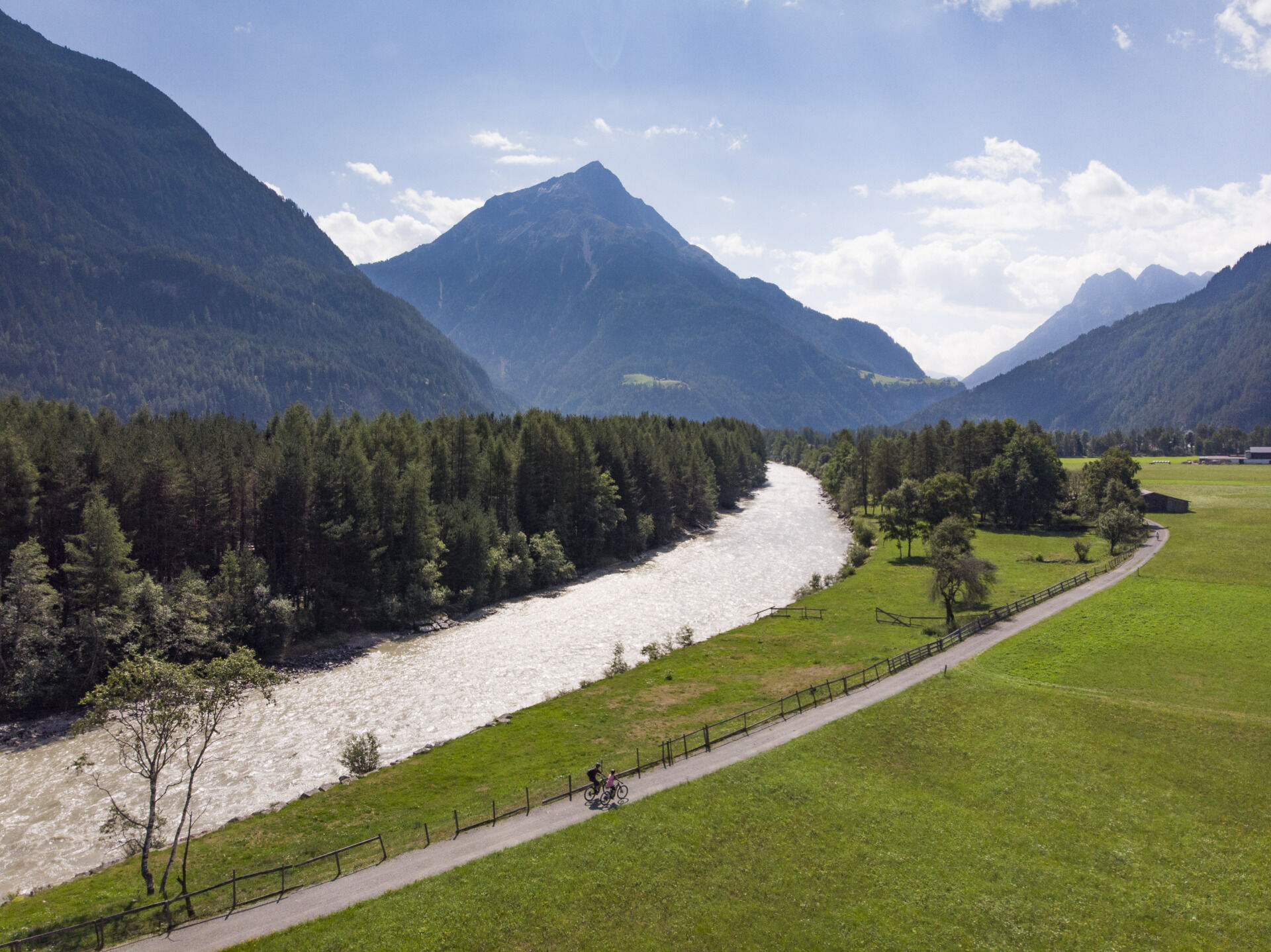
On this hike, you follow the Ötztaler Ache initially downstream and later upstream. The starting point may vary according to preference. However, we start in Längenfeld at the campsite. In front of the...
On this hike, you follow the Ötztaler Ache initially downstream and later upstream. The starting point may vary according to preference. However, we start in Längenfeld at the campsite. In front of the campsite, a path leads right between the tennis court and a small stream up to a bridge. After crossing, you stay on this path until you reach the road to Oberried. Now, cross this road and walk alongside the Ache to the hamlet Au. Here, the bridge is crossed again, and on the other river side you return to Längenfeld. Along the entire route, you enjoy the tranquility and a wonderful view of the Ötztal mountain world.

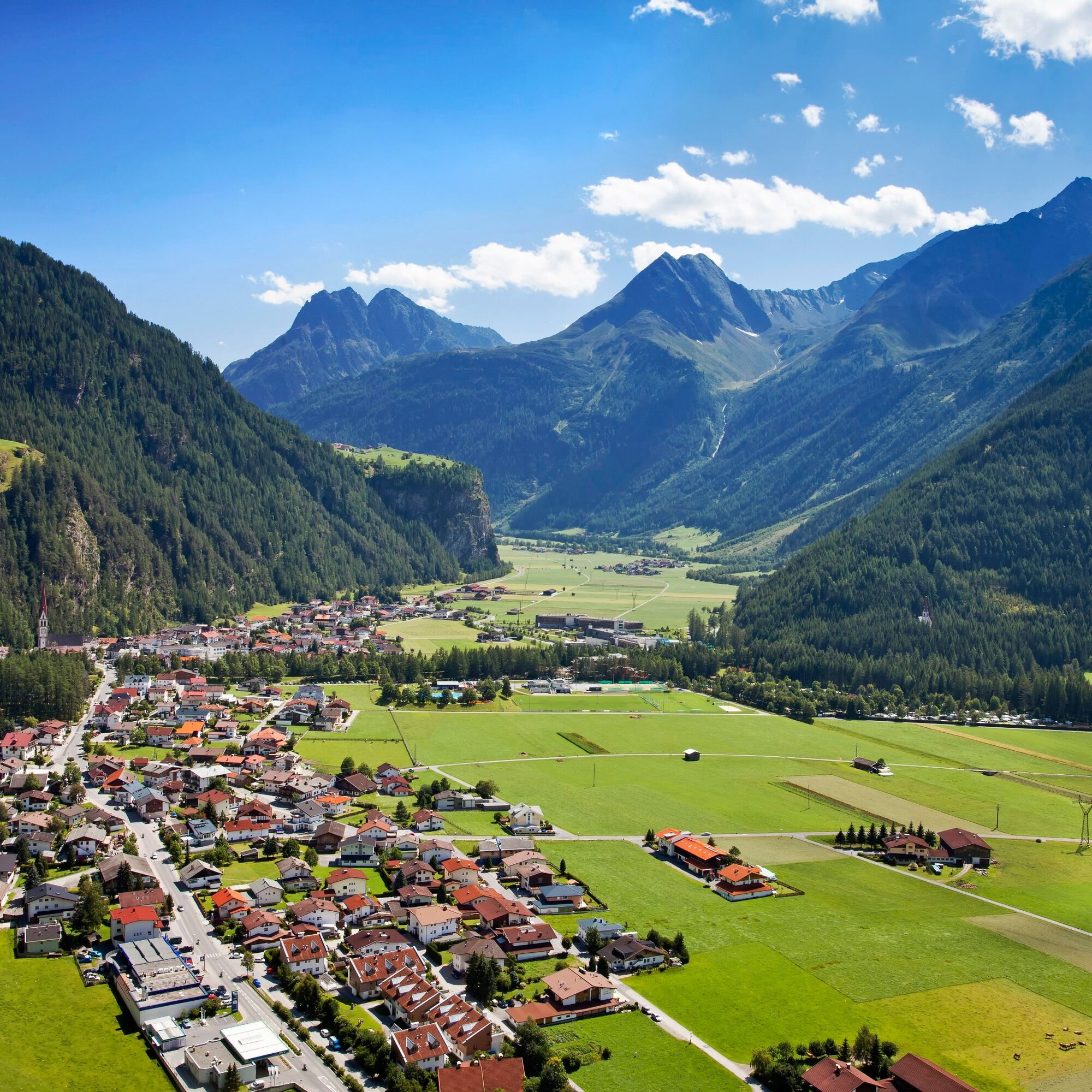
Sports center Längenfeld - from here to the road bridge to Oberried, cross it, and continue straight ahead to the hamlet Au - there you pass the bridge and take the return route on the other side of the river to the bridge in Längenfeld.
Áno
Áno
Áno
Appropriate equipment such as breathable suitable outdoor clothes for the weather.
Easy hiking trail; suitable for beginners and walkers. Please observe the current weather report.
The drive to ÖTZTAL
Arriving by car takes travelers through the Inn Valley to the valley entrance and then along the Ötztal. In addition to the toll motorway, country roads can also be used. With the route planner, your trip can be determined quickly and conveniently. Route planner: https://www.google.at/maps
Travel comfortably and safely by train. The final stop or exit point is ÖTZTAL station. Afterwards, you travel conveniently and quickly with public transport lines or local taxi companies through the entire valley to your desired destination. The current bus timetable is available at: http://fahrplan.vvt.at
The following parking options are available in Längenfeld:
Sports center – (ice rink) – free of charge Längenfeld center (small number of parking spaces) free of charge Winklen/Au in front of the bridge - opposite the electronics shop Optimal - free of chargeMore information about hiking in the Ötztal can be found here.
Since the path is mostly flat, it is also suitable for wheelchair users and prams (forest path).
Aktivity počas prehliadky

Obľúbené výlety v okolí
-
4,5
Winnebachsee Hut – Längenfeld/Gries
strednáTuristika 4,74 km -
4,2
Hike Stuibenfall - Umhausen
svetloTuristika 2,95 km -
4,4
Stuibenfall Umhausen circular hike
svetloTuristika 9,32 km -
4,4
Rundwanderung Hängebrück3
svetloTuristika 6,32 km -
4,5
Oetz - Piburger See - Oetz
strednáTuristika 7,16 km -
4,7
Winter circular route Brandalm/Burgstein - Längenfeld 204
strednáZimná turistika 5,44 km -
4,3
Lampsenspitze, Sellrain, Tirol
strednáSkitour 4,97 km -
4,3
Amberger Hut - Längenfeld/Gries
strednáTuristika 5,60 km -
4,6
Umhausen - Stuibenfall - Umhausen
strednáTuristika 7,94 km -
4,5
Summit route Weather Cross from Hochoetz
strednáTuristika 3,06 km
Turistika a stopovanie


Nenechajte si ujsť ponuky a inšpiráciu na ďalšiu dovolenku
Vaša e-mailová adresa bol pridaný do poštového zoznamu.