


HISTORIC ROAD NATERS - BELALP
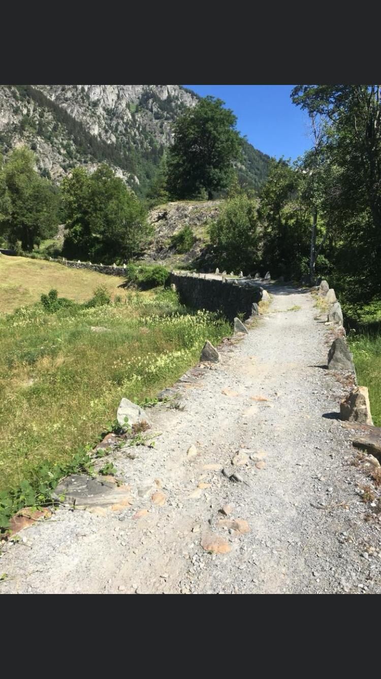
The old mountain road between Naters and Belalp is a historic route, recognizable mainly because of its traditional appearance and its structural substance. It served primarily as a mule track and cattle...
The old mountain road between Naters and Belalp is a historic route, recognizable mainly because of its traditional appearance and its structural substance. It served primarily as a mule track and cattle drive route.
The path is gently integrated into the cultural landscape of the Naters mountains. The path form is shaped by alleys, hollow and hillside paths, embankments, dry stone walls, freestanding path boundaries, boundary stones, wooden fences, stone paving, cross-slopes, mule drinking troughs, and the like.
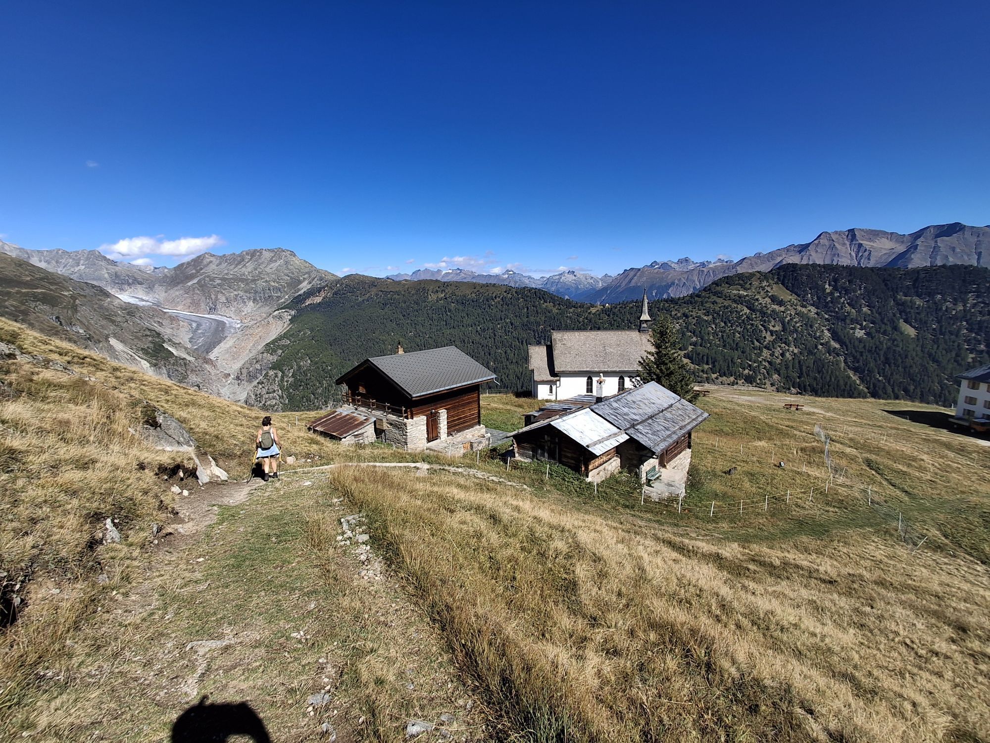
From the Aletschbord take the panoramic trail to the mountain station of the shuttle cable car from where you can comfortably return to the valley.
The route can also be divided into several stages.

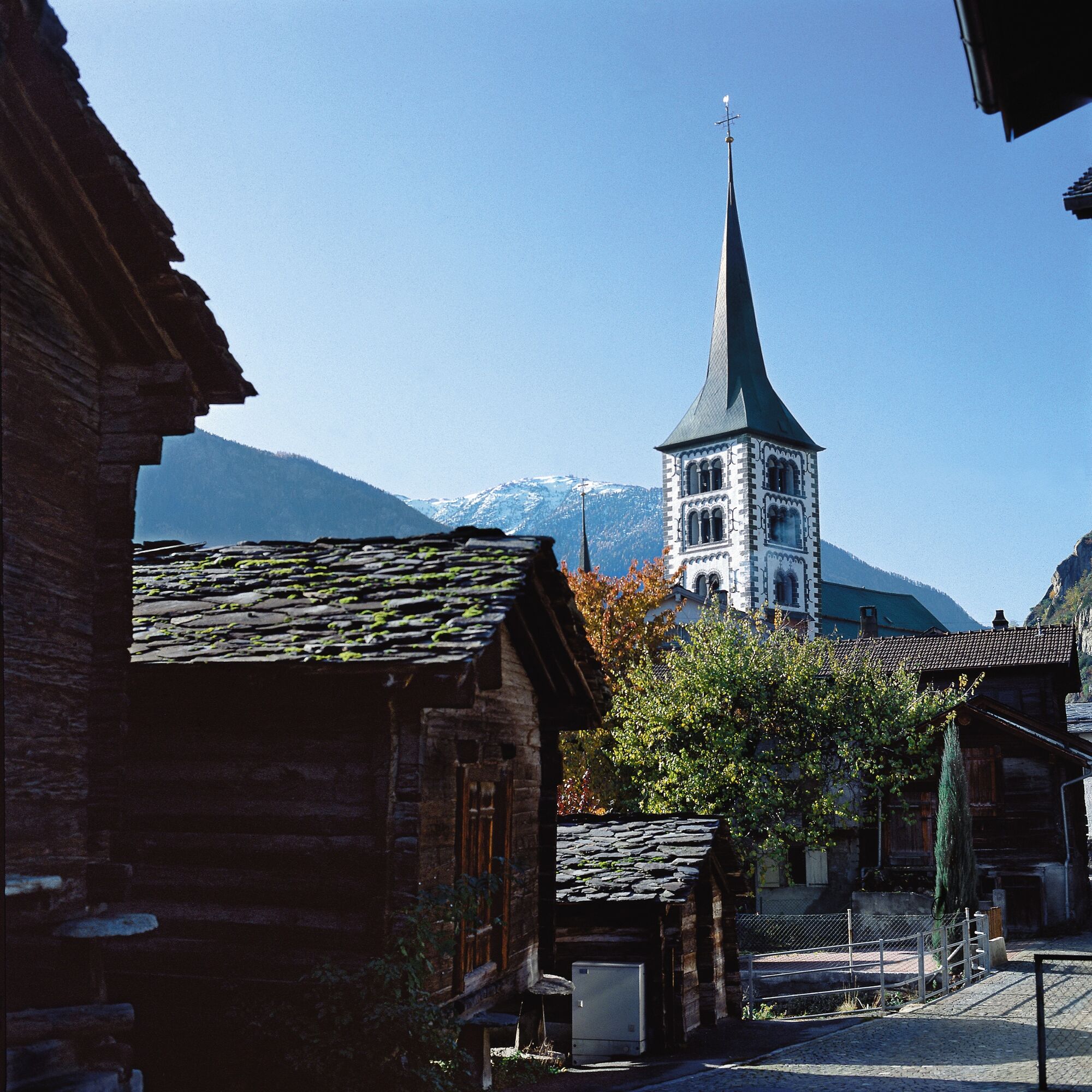
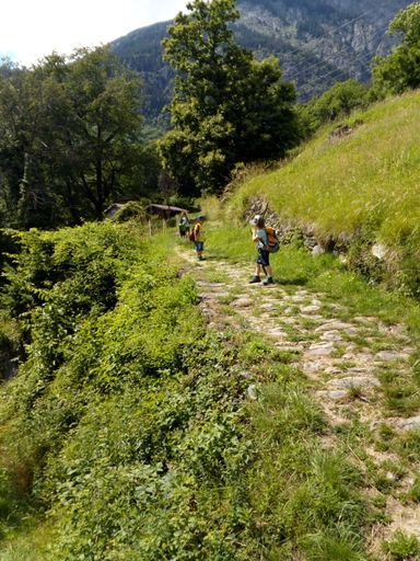


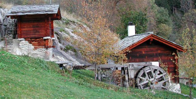
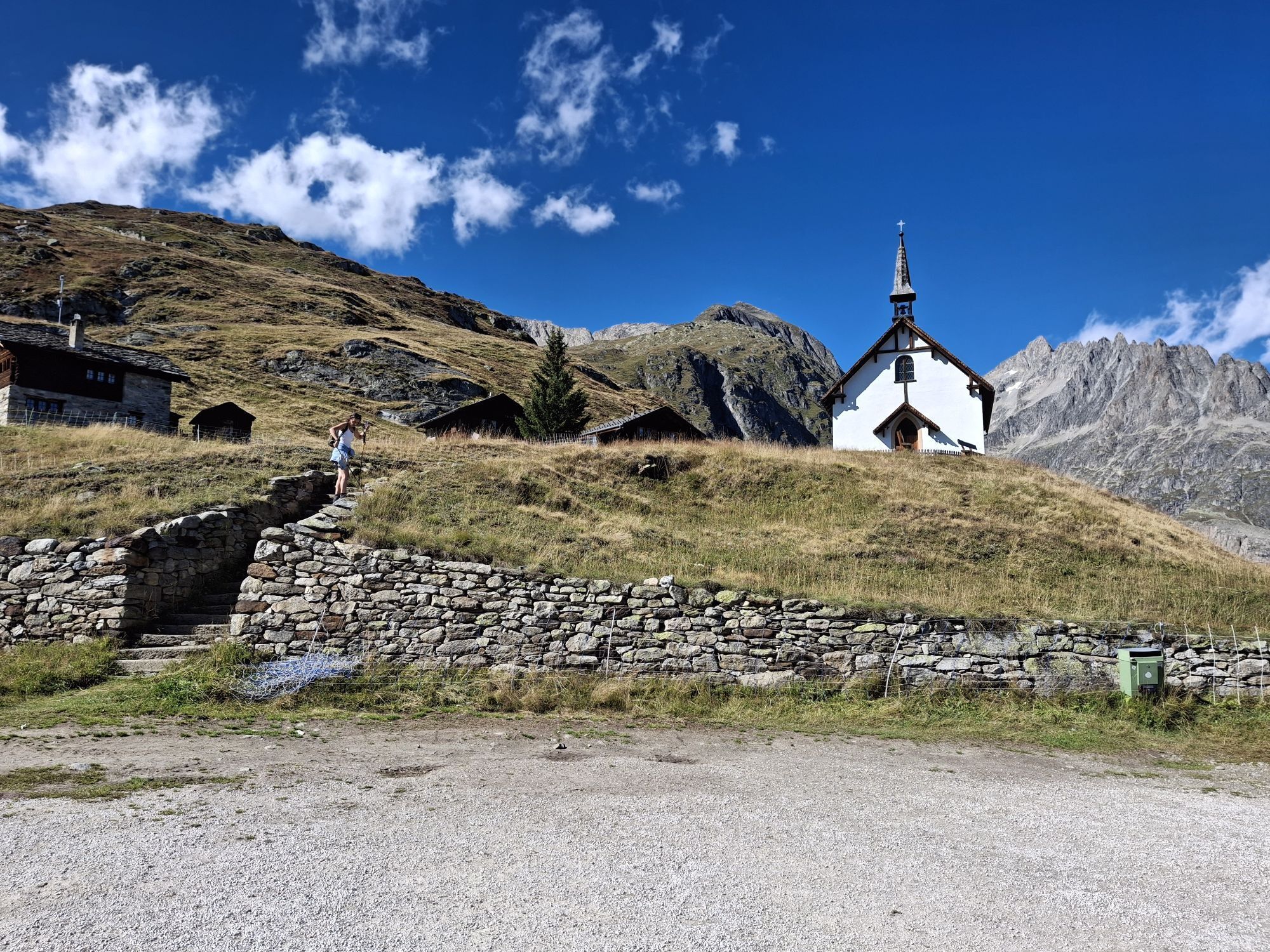
From the Naters Marktplatz stop, you go through narrow alleys, past the remarkable ossuary, the parish church, and the Junkerhof. Follow the road uphill and you reach the Klosi, where the path to Blatten branches off to the right. On the way, in the section between Moos and Obermoos, a mule drinking trough carved in stone is visible on the left side. After passing through Geimen, you begin the further ascent towards Blatten bei Naters. Either follow the historic road or take the alternative route through the wooded Blindtal. After a short break in the old village part of Blatten bei Naters, continue towards Egga and Belalp. For this, head towards Rischinen and shortly before crossing the "Bruchji" stream, rejoin the hiking trail which first leads you to Egga and then through the larch forest up to Belalp.
Naters - Klosi - Moos - Geimen - Mehlbaum – Blatten bei Naters - Rischinen - Belalp Aletschbord
Áno
Áno
Sturdy footwear, weather-appropriate clothing, sun and rain protection, as well as sufficient supplies of food and drink, are recommended in case there are no opportunities to stop for food or shopping, or if they are closed. Although the path is continuously very well marked, you should always carry a suitable hiking map for safety reasons. Bring poles or other aids.
Despite the "unmistakable" marking of the hiking trails, for safety reasons we always recommend carrying a corresponding hiking map so that, for example, in the event of a thunderstorm or emergency, you can quickly find a safe area.
Especially in autumn, be mindful that the fallen leaves on the ground can conceal unevenness, roots, stones, or holes in the path. After storms, trees may still fall or branches may drop. Particularly in adverse weather conditions, natural paths can have muddy and slippery sections. You should expect such path impairments if you undertake a hike.
Not all rocks or precipices are secured with ropes or railings. Surefootedness is required in places. If you believe that certain sections are not passable for you, you should avoid them.
Arrival by car
From Western Switzerland: A9 Lausanne - Vevey, or Northwestern Switzerland: A12 Bern - Vevey: A9 - Sierre: main road Sierre - Brig
From Northwestern Switzerland: A6 Bern - Thun - Spiez: main road Spiez - Kandersteg (car shuttle Lötschberg tunnel) - Goppenstein - Gampel - Brig
From Eastern and Central Switzerland: Andermatt - Realp (year-round car shuttle Furka; in summer via Furka pass) - Oberwald - Brig
From Ticino (in summer): Airolo - Nufenen Pass - Ulrichen – Brig
Or via Centovalli – Domodossola – Simplon Pass – Brig
From Italy (Aosta, Mt. Blanc Tunnel): Aosta - Grand Saint Bernard Tunnel (in summer via the pass) - Martigny: highway A9 - Sierre: main road Sierre – Brig
Or via Domodossola – Simplon Pass – Brig
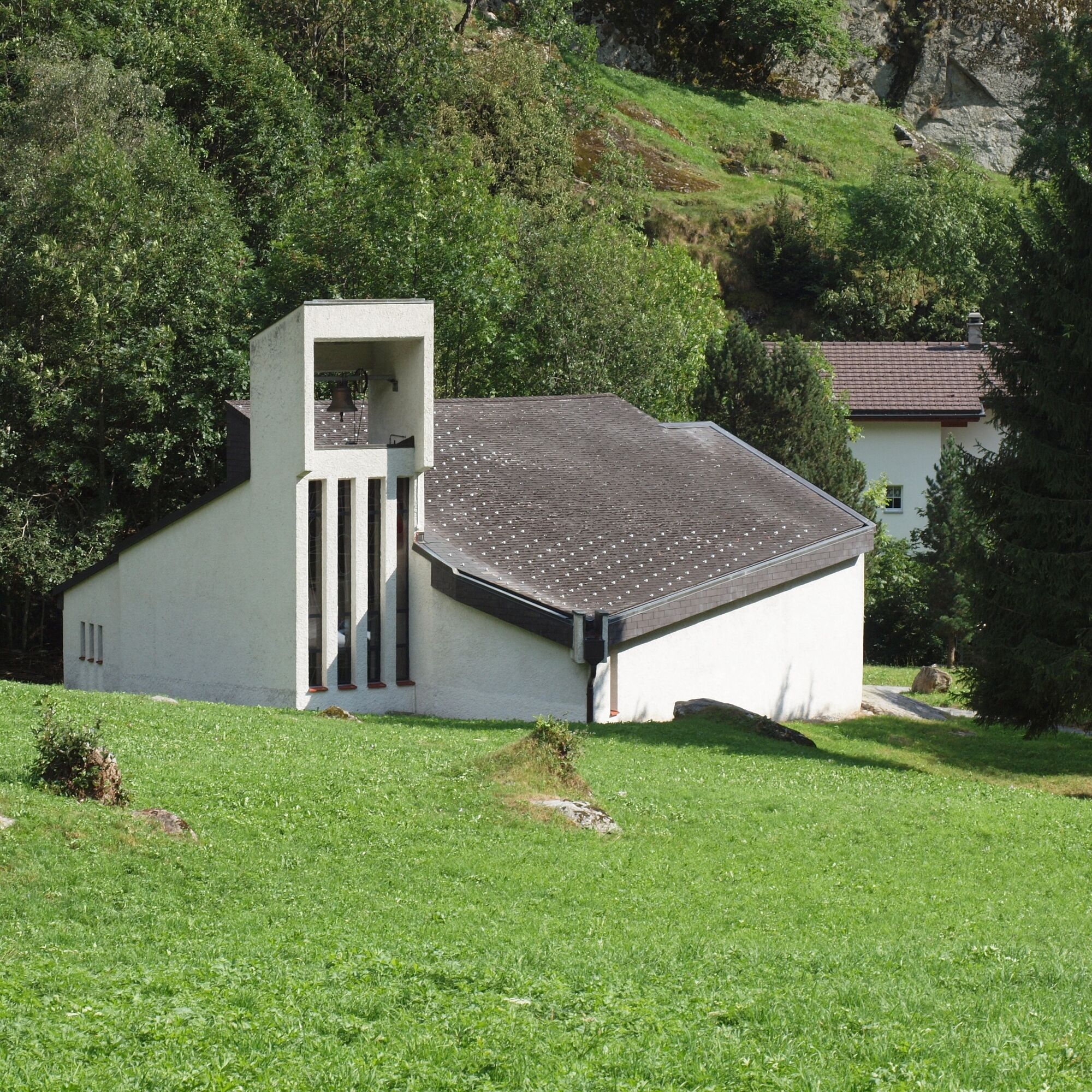
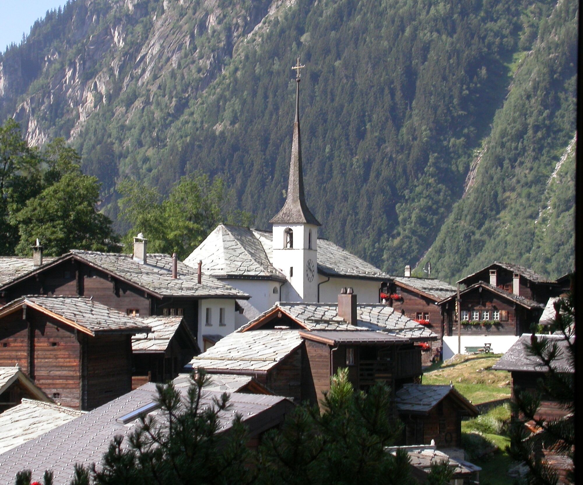
Blatten bei Naters
From Brig, you reach Blatten bei Naters via Naters, then continue by cable car to the car-free Belalp.
Naters
Take the post bus or the local bus (line 1) from Brig to Naters Marktplatz and start your route there.
You can also start your route by walking directly from Brig through Naters.
Blatten-Belalp
Blatten bei Naters is accessible from Brig or Naters by public transport.
You reach Belalp from Blatten by cable car.
The timetable and further information for travel can be found at: www.belalp.ch
Naters
Several paid parking lots and parking garages are available both in Naters and in Brig.
Blatten-Belalp
Paid parking spaces are available in Chienzlichrommu and in the parking garage in Blatten bei Naters.
Further information can be found at:
www.belalp.ch
If you have questions, please contact:
Belalp Bahnen AG
Blatten - Belalp Tourismus AG
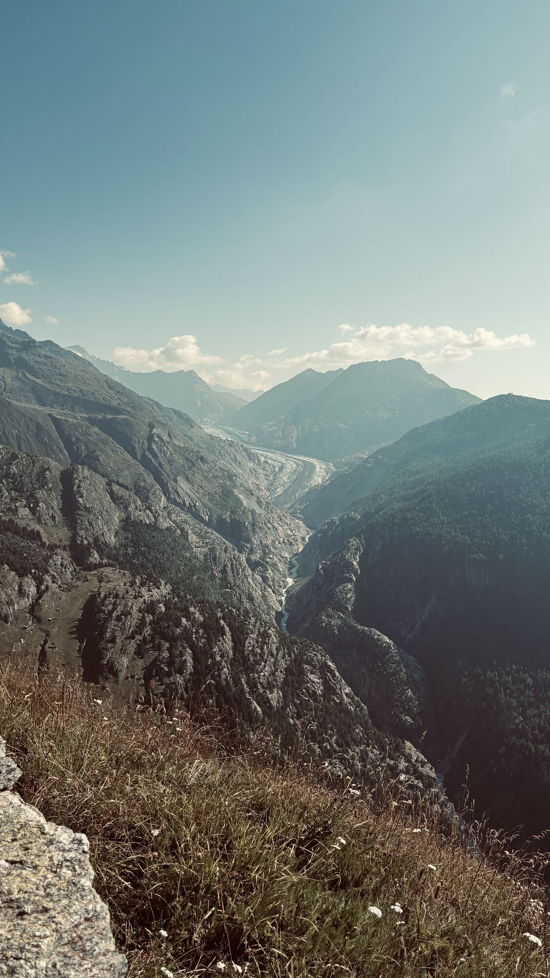
At the Aletschbord, there is a good view of the Great Aletsch Glacier.
Enjoy a fine coffee at the mountain guide's pub in Egga
Webové kamery z prehliadky
-
Talstation Sesselbahn Bruchegg
-
Belalp Hexenland
-
Belalp - Feriensiedlung Tschuggen
-
Termen
-
Moosfluh Bergstation
-
Moosfluh Bergstation
-
Moosfluh Bergstation
-
Moosfluh Bergstation
-
Moosfluh Bergstation
-
Moosfluh Bergstation
-
Golfclub Riederalp
-
Rosswald
-
Stockalperschloss
-
Rosswald
-
Rosswald
-
Rosswald
-
Rosswald
-
Rosswald
-
Aletschbord

Obľúbené výlety v okolí
-
4,7
Lötschentaler Höhenweg
svetloTuristika 9,17 km -
UNESCO Höhenweg
Turistika 3,70 km -
5,0
Rundwanderung Anenhütte
strednáTuristika 10,2 km -
4,0
Panoramaweg über den Aletschgletscher
strednáTuristika 17,7 km -
4,7
SUSPENSION BRIDGE RIEDERALP - BELALP
strednáTuristika 11,5 km -
5,0
VIA FERRATA "ALETSCH"
strednáVia ferrata 3,40 km -
CIRCULAR HIKE MASSEGGA SUSPENSION BRIDGE
svetloTuristika 6,44 km -
4,0
Eggishorn via ferrata
strednáVia ferrata 1,39 km -
5,0
Aletsch Sightseeing
strednáZimná turistika 15,5 km -
4,0
NATICHERBERG CIRCULAR TRAIL
strednáTuristika 12,1 km
Turistika a stopovanie


Nenechajte si ujsť ponuky a inšpiráciu na ďalšiu dovolenku
Vaša e-mailová adresa bol pridaný do poštového zoznamu.