


Wine Route: Sion – Venthône (Stage 3)
Fotografie našich používateľov
-

 © Heinrich MocelliniVytvorené dňa 24.04.2025
 -
 © Heinrich MocelliniVytvorené dňa 24.04.2025
 -
 © Heinrich MocelliniVytvorené dňa 24.04.2025
 -
 © Heinrich MocelliniVytvorené dňa 24.04.2025
 -
 © Heinrich MocelliniVytvorené dňa 24.04.2025
 -
 © Heinrich MocelliniVytvorené dňa 24.04.2025
 -

 © Jean-Pierre SionVytvorené dňa 06.03.2025
 -
 © Jean-Pierre SionVytvorené dňa 06.03.2025
 -
 © peter_oeVytvorené dňa 24.10.2024
 -
 © peter_oeVytvorené dňa 24.10.2024
 -
 © peter_oeVytvorené dňa 24.10.2024
 -
 © peter_oeVytvorené dňa 24.10.2024
 -
 © peter_oeVytvorené dňa 24.10.2024

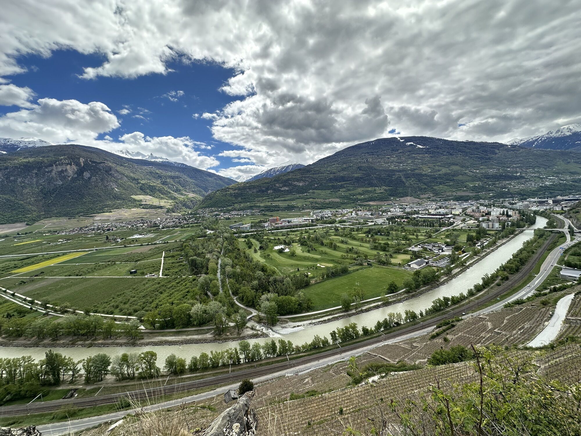
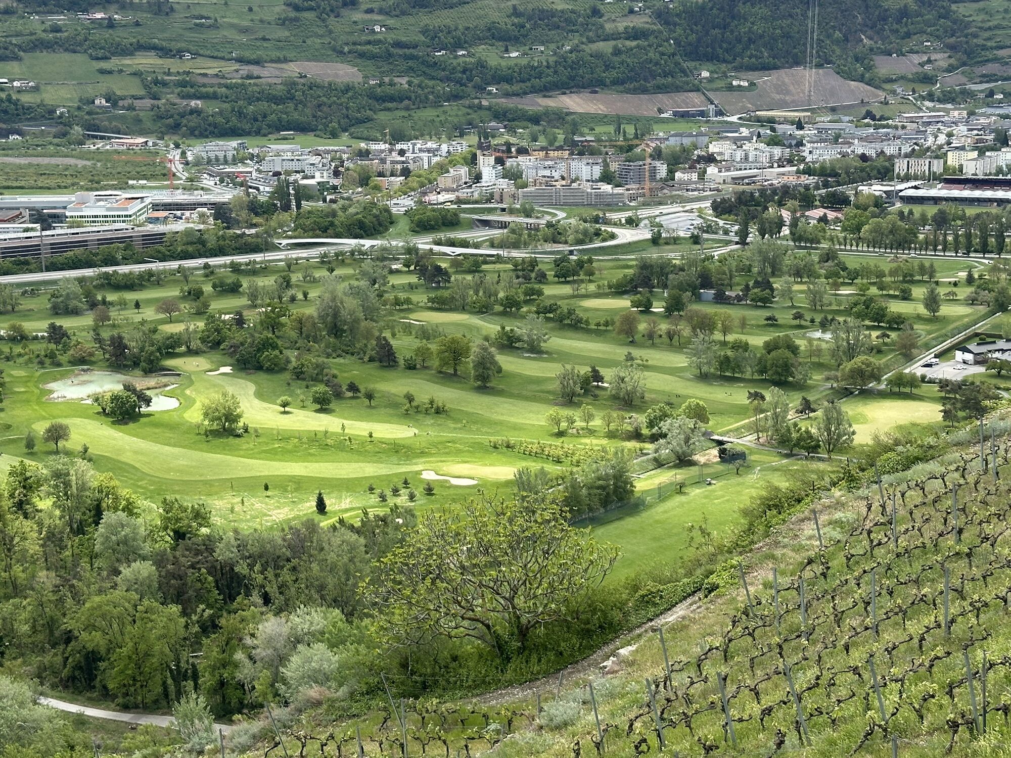


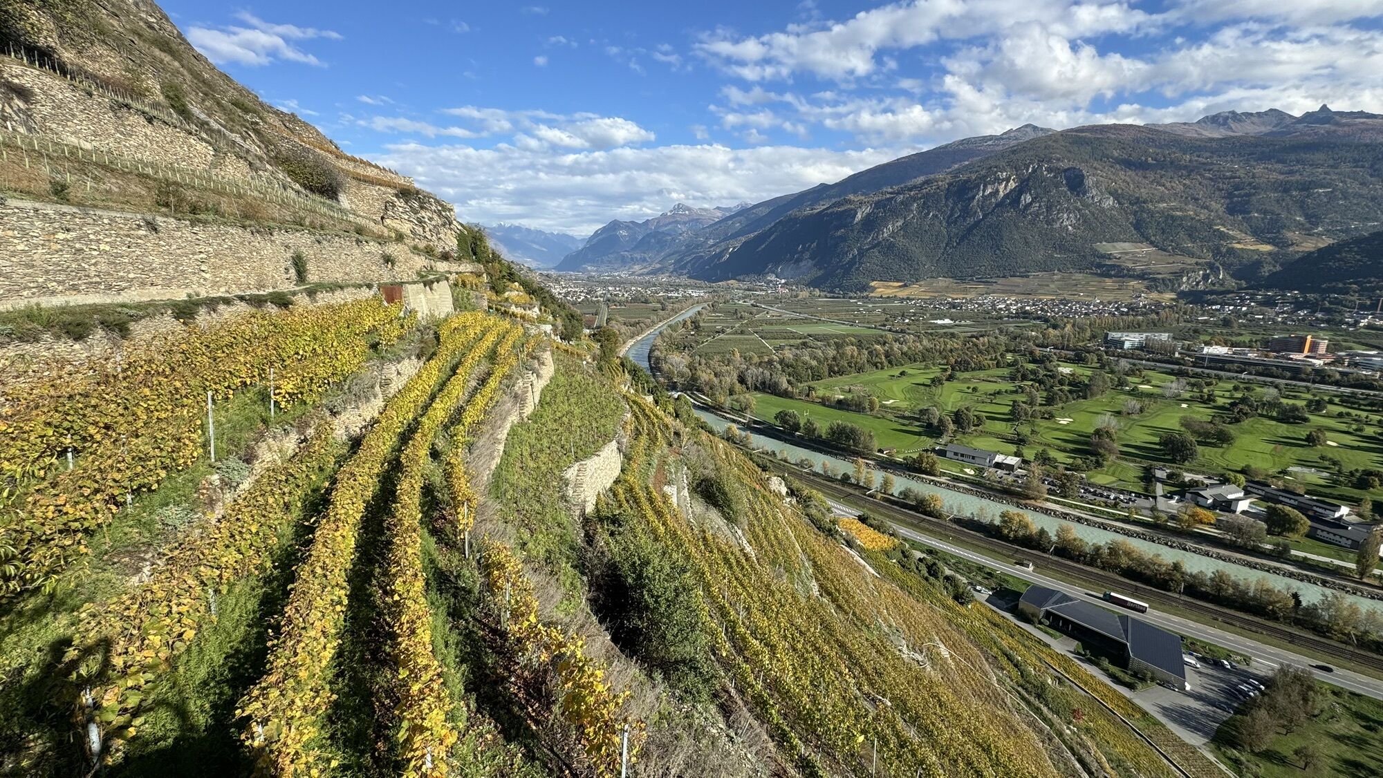
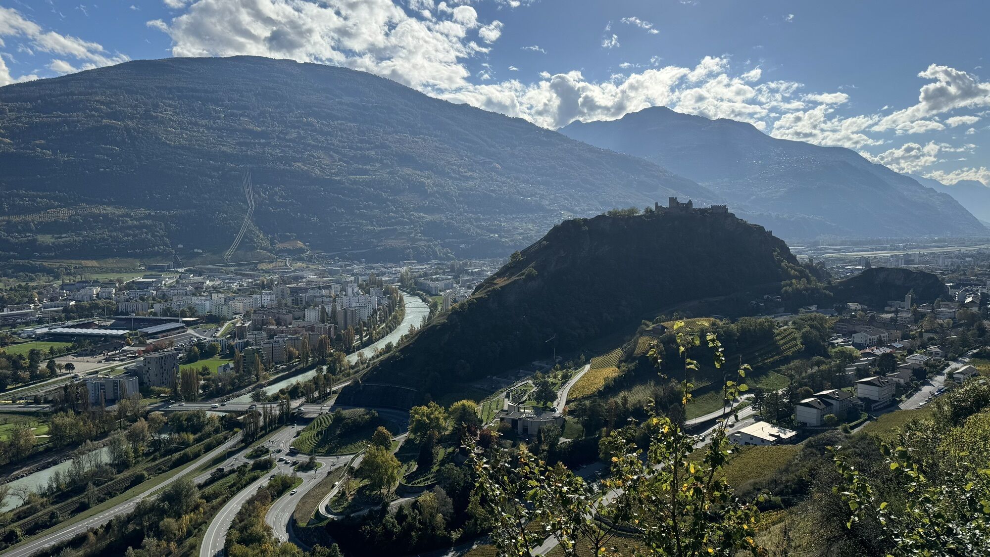
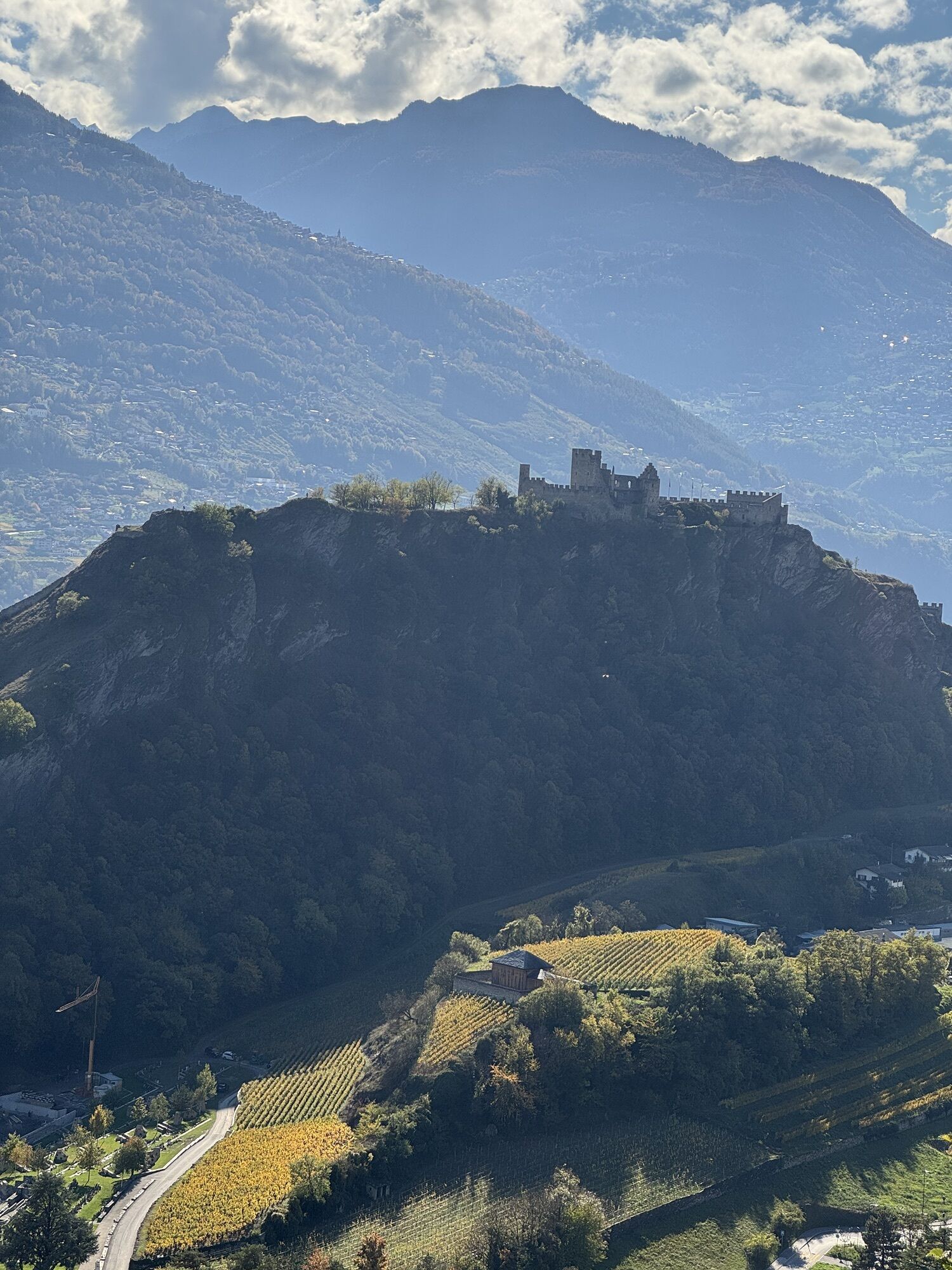

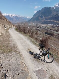
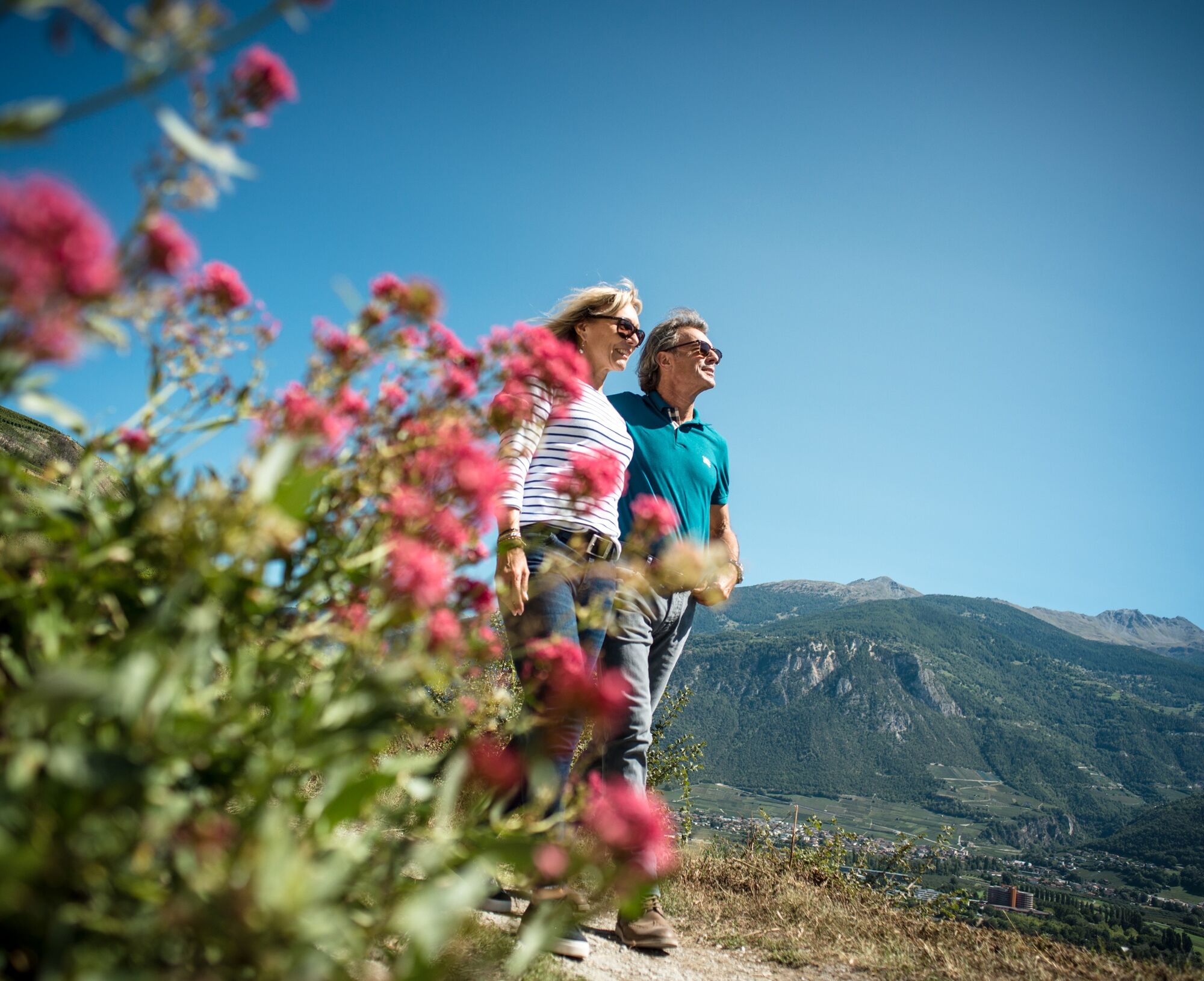
The wine route follows a scenic path along the sunny southern slopes and through charming winegrower villages in the Valais wine region. The wine route can be explored in three ways – by car, by bike,...
The wine route follows a scenic path along the sunny southern slopes and through charming winegrower villages in the Valais wine region. The wine route can be explored in three ways – by car, by bike, or on foot. The 65-kilometer hike, consisting of 4 stages, allows you not to miss any of the numerous sights.
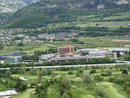
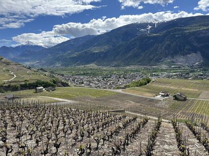
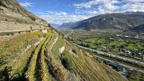
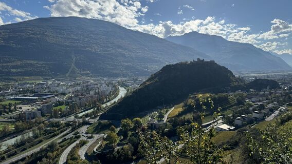
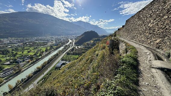
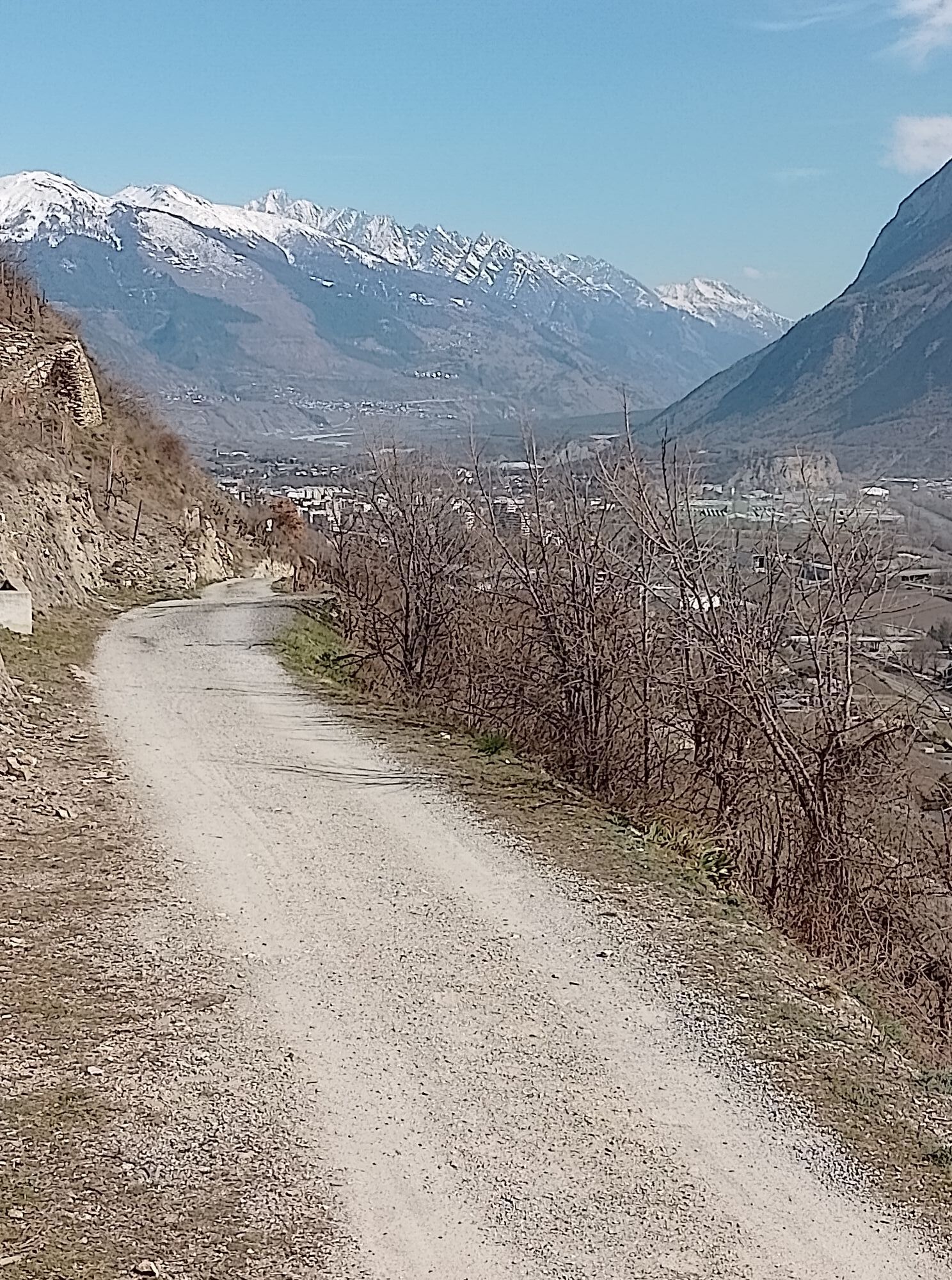
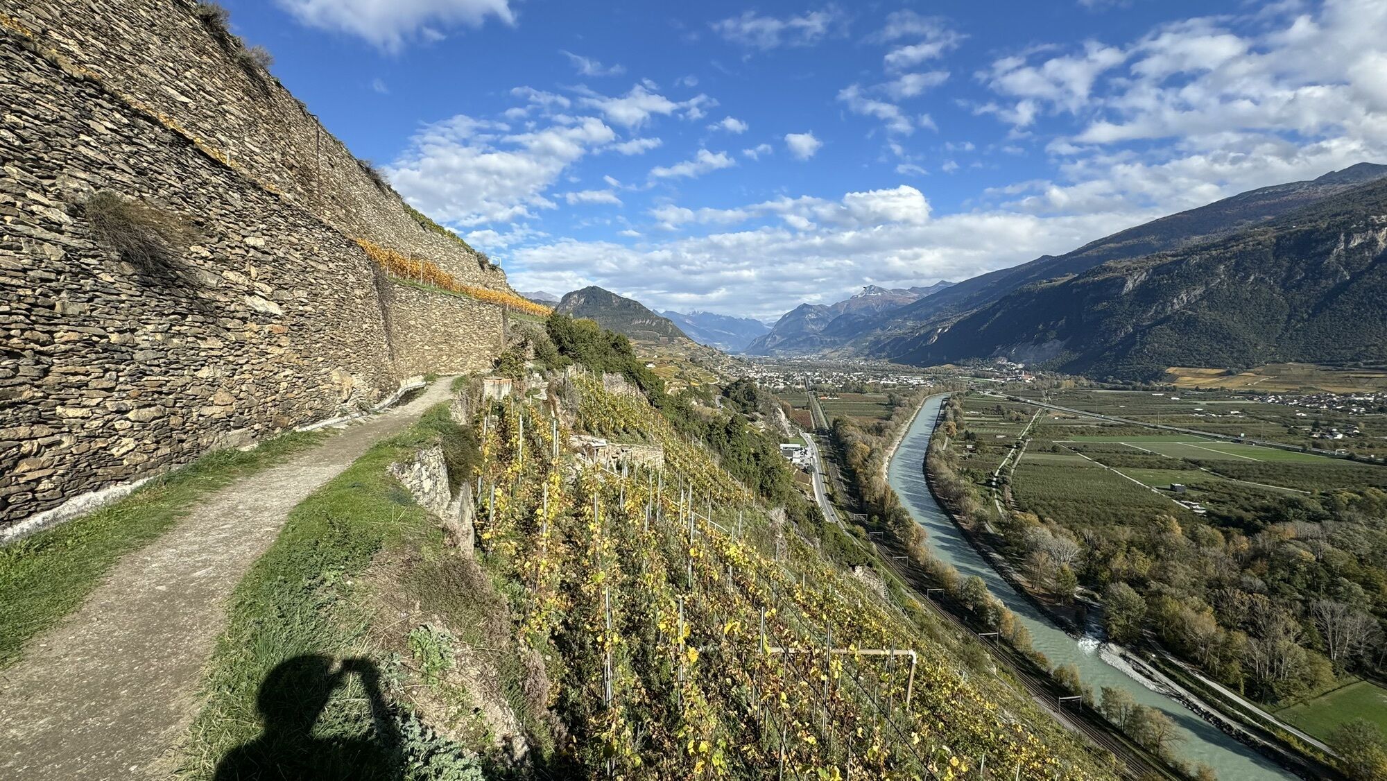
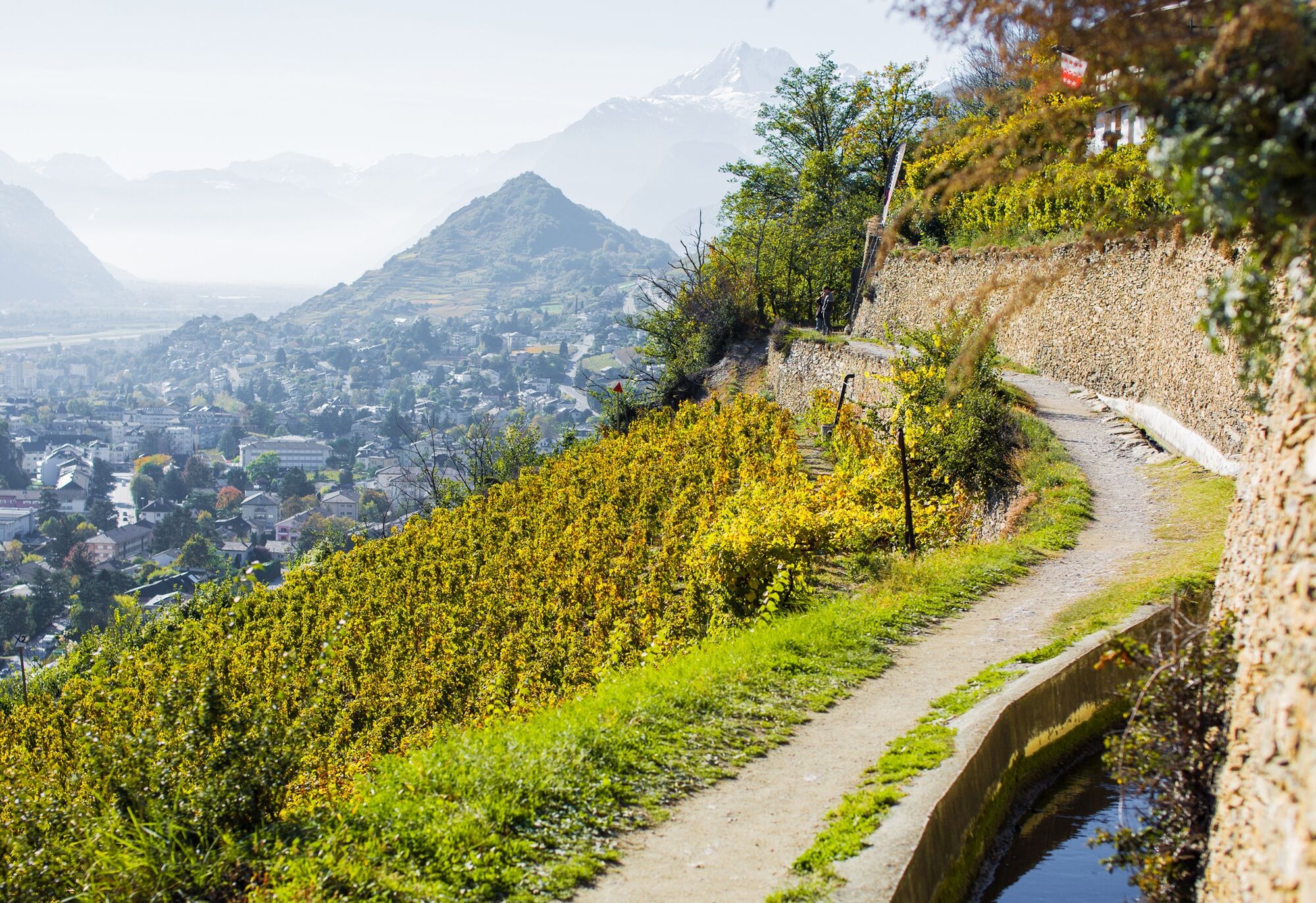
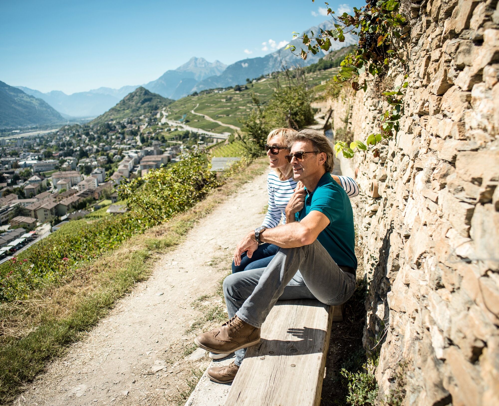
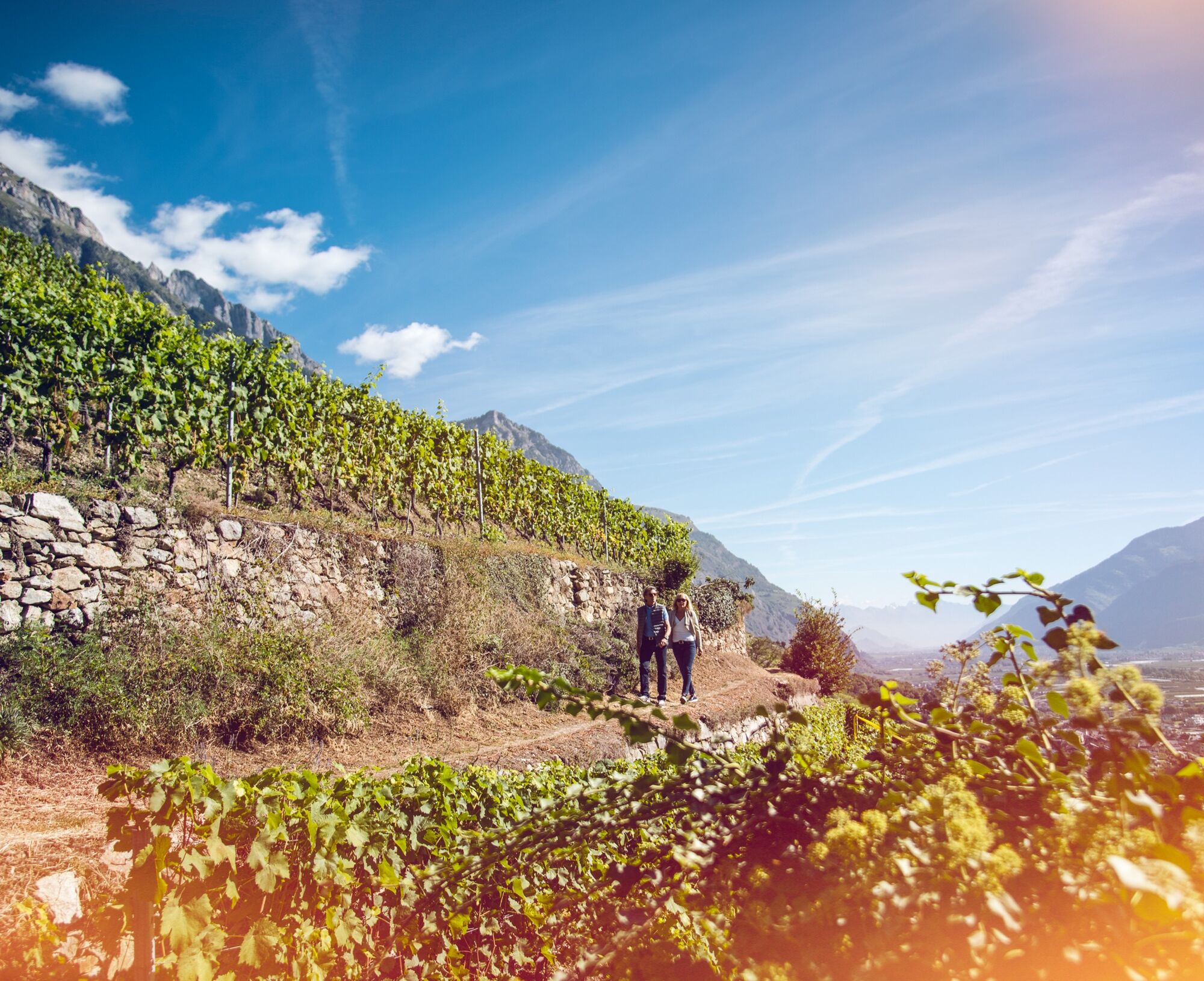
Along the third stage from the northern outskirts of Sion, the hike passes through the vineyards to Venthône above Sierre. Here, the Rhone valley becomes noticeably narrower than during the first two stages. Water accompanies the hikers throughout the tour: the route follows a Suone, one of the historic irrigation canals that transported water from glaciers to the vineyards and orchards.
The Bisse de Clavau was built in the 15th century and runs through the steepest terraced vineyards in the world with fantastic views of the old town of Sion. The first section passes numerous wine cottages that invite you to wine tasting on terraces beautifully shaded by grapevines.
The hike leads through the gorge of the La Liène stream and leaves the Suone here. Then follows a short detour to the village of St-Léonard, crossing the river there to ascend again into the vineyards on the other side. The path here passes above an unusual attraction: the largest navigable underground lake in Europe. You can reach the lake from the village and book a guided boat tour on the crystal-clear water of the lake.
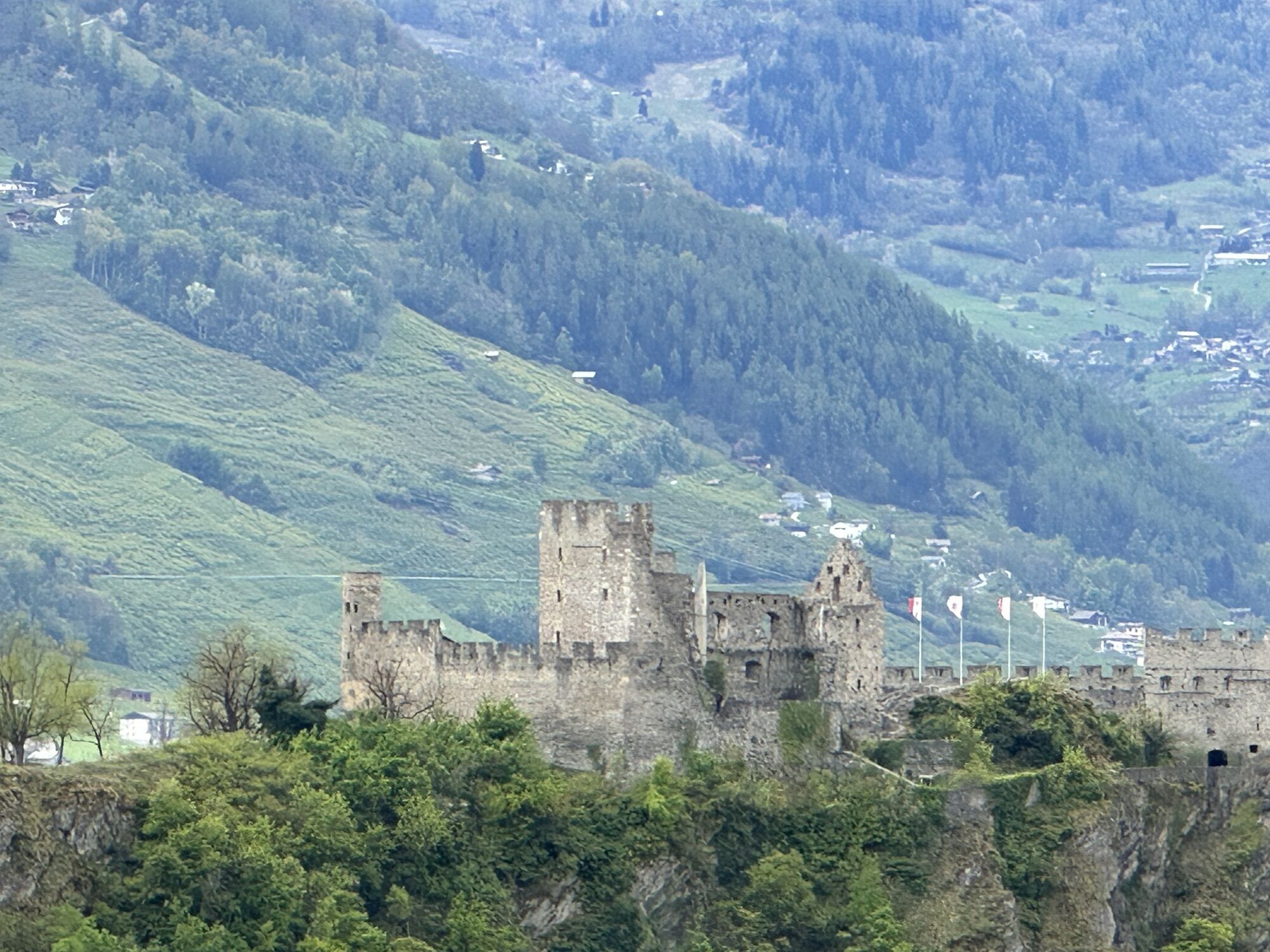
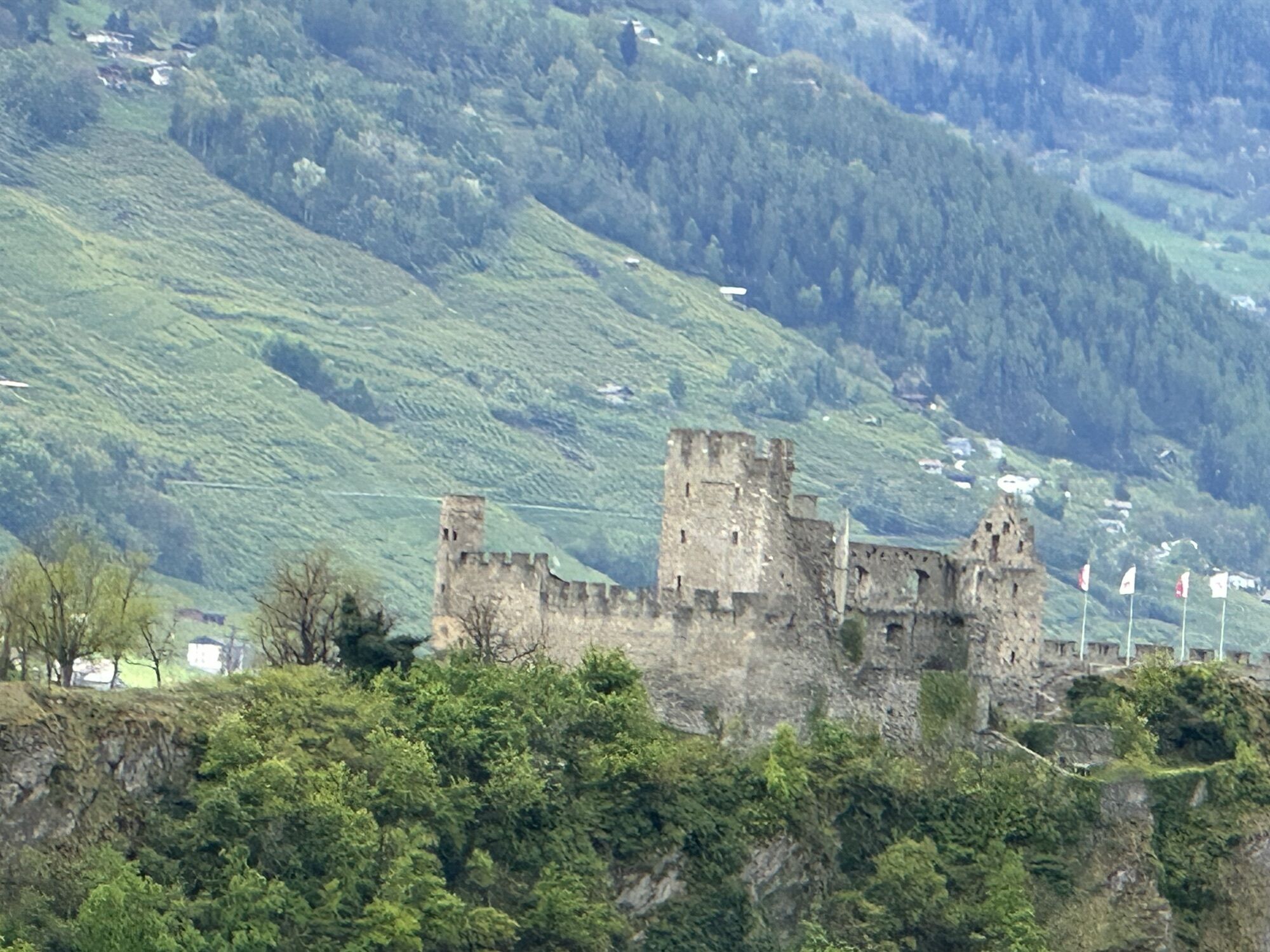
The path continues through some wine villages to the end point of the stage in Venthône. The village consists of a series of medieval buildings with a watchtower from the 12th century. The building is now used as a restaurant and regularly hosts exhibitions.
Highlights of the hike:
Bisse de Clavau – historic Suone with great views of Sion and numerous wine cottages for a break with tasting opportunities. The largest navigable underground lake in St-Léonard. Some beautiful wine villages with numerous tasting opportunities in the cellars.
Regular train connections to Sion, then by bus (direction Anzère or Crans-Montana) to the Brasserie stop. At the end of the hike, you can take a bus again from the Village stop to Sierre. Detailed timetables for trains and post buses can be found at sbb.ch.
Áno
We recommend:
Good footwear Weather-dependent clothing: always carry a waterproof vest Headwear Sunscreen Water bottle Picnic Camera Binoculars (optional) Hiking poles (optional) Printout of the hiking route (click "Print" to download)For certain hikes:
SwimsuitThe mountains, a place of joy to share and respect. The mountain world is a place to meet and enjoy unforgettable moments together – whether by bike or on foot. To ensure all users benefit, it is essential to share this space with respect for nature and agriculture. Respectful behaviour allows everyone to pursue their leisure activities under the best conditions. Inform yourself about recommendations and rules. Assess your own skills and fitness well. Using the various routes is fundamentally at your own risk.
For all hikes:
Carry a map with you. Download the complete description of the hiking route with a large-scale map by clicking "Print" at the top right of the page. Use only marked hiking paths and observe all signposts and instructions – for your own safety, to protect grazing animals, and out of respect for wildlife. Close gates after passing through. Behave considerately towards other path users, plants, and animals.For mountain hikes:
Carry additional sunscreen. UV rays at high altitudes can be very strong, even in cloudy weather. Plan your hike carefully: consider the required fitness level of all participants, weather forecasts, and seasonal dependencies. Weather conditions can change very quickly and without warning in the mountains. Appropriate clothing and sufficient provisions (food and drink) are very important. In unsettled weather, it is better to turn back early.For high alpine hikes:
Inform your family about your hiking route. If possible, avoid going alone. Do not venture onto glaciers without a mountain guide. Observe warning signs that indicate dangers at riverbanks, along waterways below dams and reservoirs: water levels can rise quickly and without warning.Motorway A9, exit 27 (Sion-Est). Follow the signs towards Grimisuat, go through the tunnel. At the tunnel exit, turn left at the roundabout. The start of the hike is just a short distance below.
Regular train connections to Sion, then by bus (direction Anzère or Crans-Montana) to the Brasserie stop. At the end of the hike, you can take a bus again from the Village stop to Sierre. Detailed timetables for trains and post buses can be found at sbb.ch.
Public parking in Sion near the Brasserie bus stop. Follow the local parking guidance system in Sion.
More information about the destination:
SionComplete the hike during the grape harvest in autumn to experience the work in the vineyard up close. The exact timing of the "Wimden" varies from year to year; please check directly with the local tourist offices.
Obľúbené výlety v okolí
-
5,0
Bella-Tola
strednáVysoké turné 6,72 km -
4,0
Grand Bisse de Lens
svetloTuristika 8,73 km -
4,0
Tripon - Brac – Ancien Bisse du Torrent Neuf – St. Marguerite – Torrent Neuf – Prafirmin - St. Germain
svetloTuristika 12,9 km -
4,0
Belvédère via ferrata
strednáVia ferrata 1,81 km -
5,0
Wildstrubel Umrundung 4-Tage
strednáTuristika 79,1 km -
Grand bisse d’Ayent
strednáTuristika 11,7 km -
4,5
Sentier viticole / Wine trail
svetloTuristika 7,49 km -
Bisse du Tsittoret
strednáTuristika 10,6 km -
5,0
Wine route: Venthône – Leuk (Stage 4)
strednáTuristika 12,8 km -
5,0
Mayentset Bike
strednáMountainbike 21,6 km

Turistika a stopovanie


Nenechajte si ujsť ponuky a inšpiráciu na ďalšiu dovolenku
Vaša e-mailová adresa bol pridaný do poštového zoznamu.