


Leg 27 2nd Variant from Dolceacqua (Via Airole) to Grimaldi
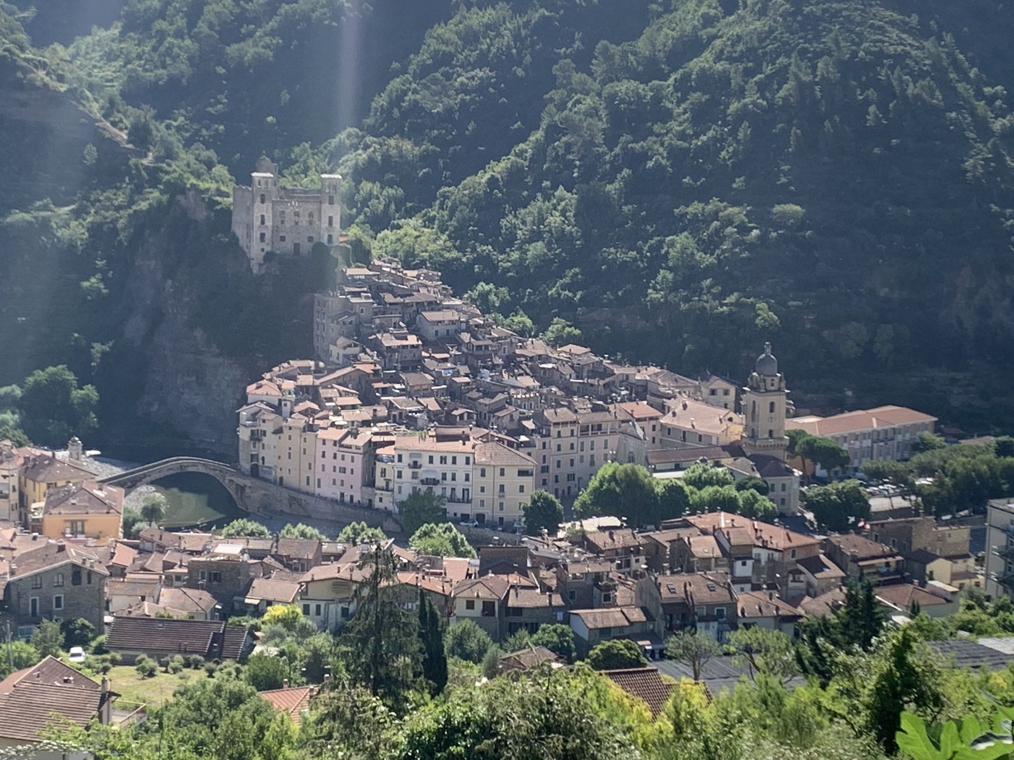
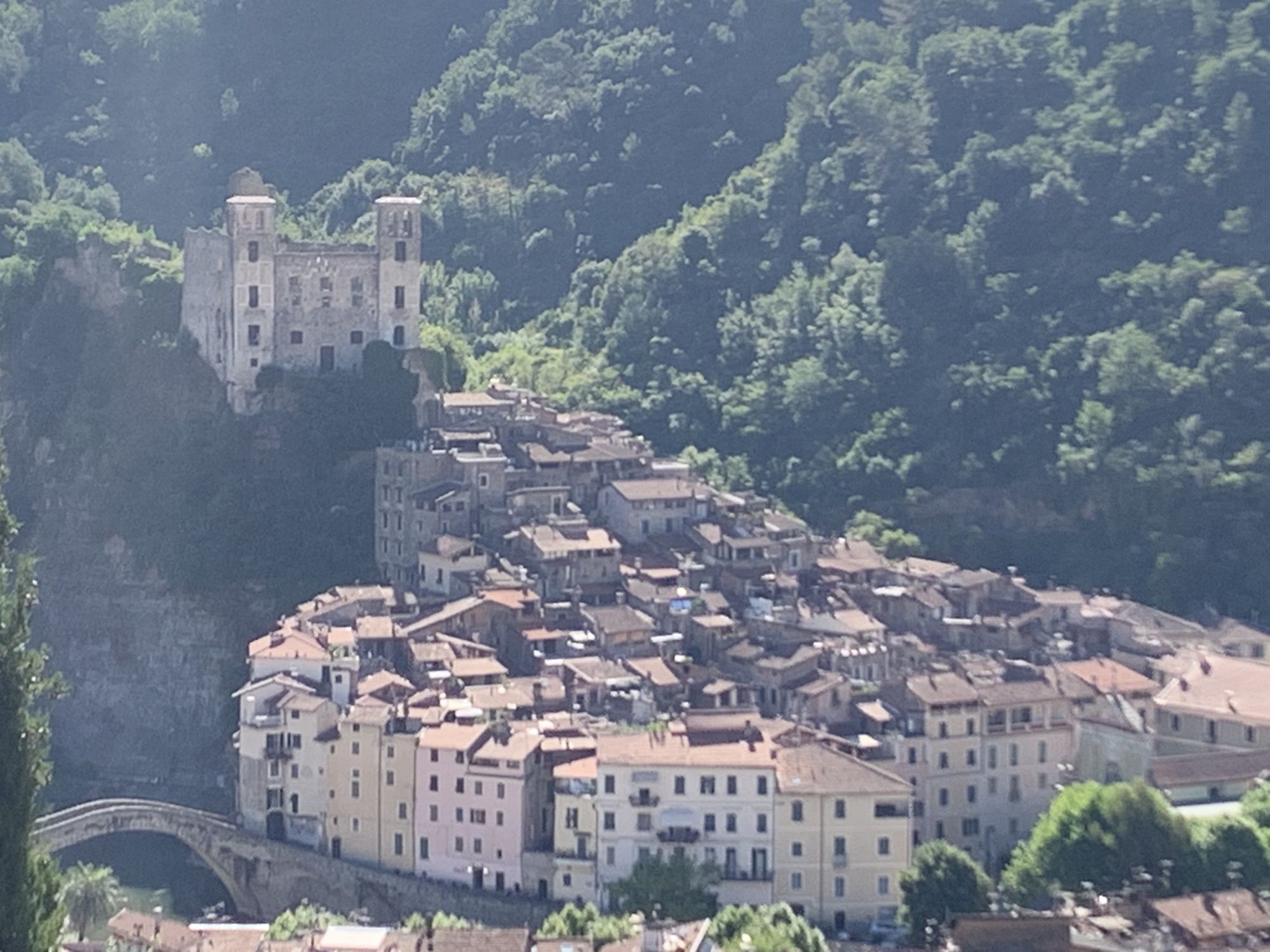
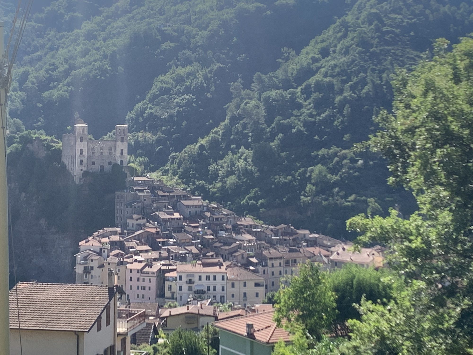
From the centre of Dolceacqua, the itinerary follows the Alta Via dei Monti Liguri westwards. A first long ascend will allow you to reach an altitude of 800 metres, bringing you into a typical mountain...
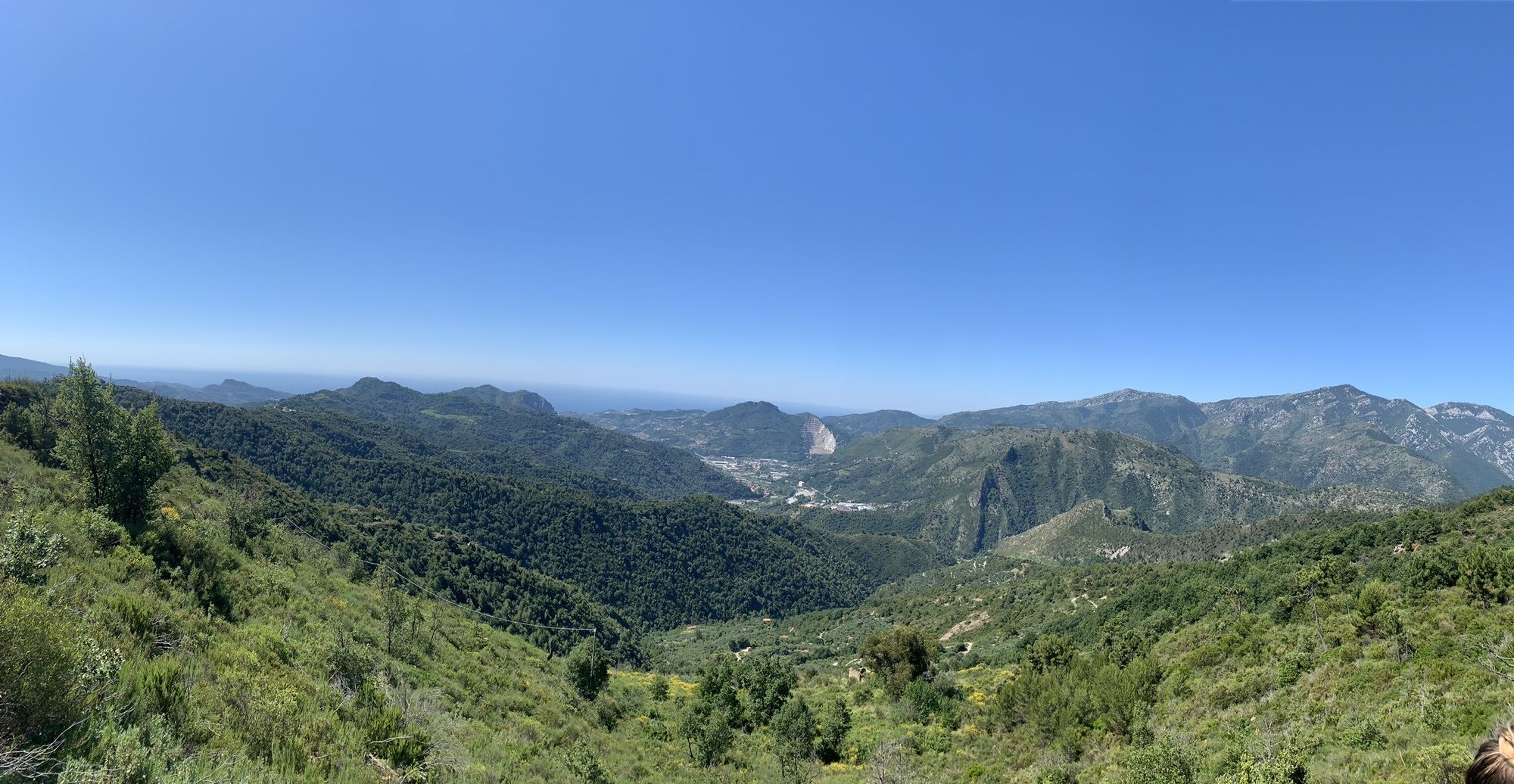
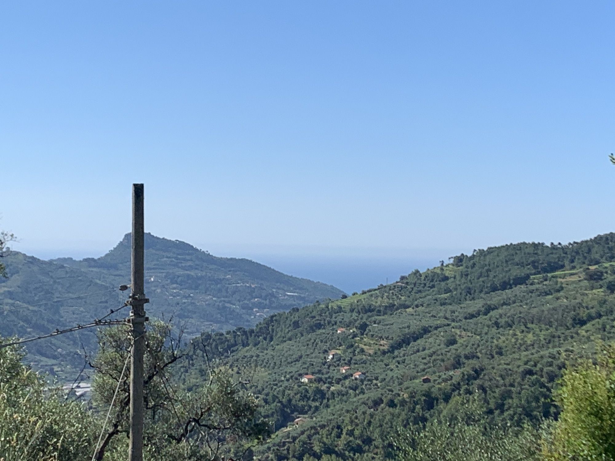
From the centre of Dolceacqua, the itinerary follows the Alta Via dei Monti Liguri westwards. A first long ascend will allow you to reach an altitude of 800 metres, bringing you into a typical mountain landscape. Once in the Nervia and Roya valleys, this characteristic environment turns into a river landscape, before changing again into a typical Mediterranean environment in the last part. This leg of the Sentiero Liguria passes through the hamlets Airole and Torri, where the hiker can find a friendly hospitality for a short or long stop.

Obľúbené výlety v okolí
-
IM_18 San Romolo – Monte Bignone
Turistika 3,41 km -
Trail no. 01: Ventimiglia - La Colla
strednáTuristika 10,4 km -
5,0
Goldtoni - Alpenbogen A102 Monaco-Sospel
svetlodiaľková pešia trasa 29,7 km -
IM_15 Laghetti del Rio Sgorela (Val Barbaira)
Turistika 2,95 km -
IM_20 Bordighera – Seborga
Turistika 15,2 km -
IM_14 San Michele (train station) - Monte Grammondo
Turistika 8,78 km -
Tubi di San Lorenzo
ťažkéMountainbike 3,03 km -
Red Cliffs
strednáMountainbike 2,38 km -
Le Creste
ťažkéMountainbike 5,22 km -
Alla frontiera 30.08.2024
svetloTuristika 8,01 km
Turistika a stopovanie


Nenechajte si ujsť ponuky a inšpiráciu na ďalšiu dovolenku
Vaša e-mailová adresa bol pridaný do poštového zoznamu.