


OULX Gad - Monfol (Gran Bosco Natural Park)
The path connects the Gad hamlet of Oulx to Monfol just above Sauze d'Oulx, covering a total elevation gain of about 550 m.
Downstream, the Rio Gran Comba bears the marks of numerous past floods; higher...
The path connects the Gad hamlet of Oulx to Monfol just above Sauze d'Oulx, covering a total elevation gain of about 550 m.
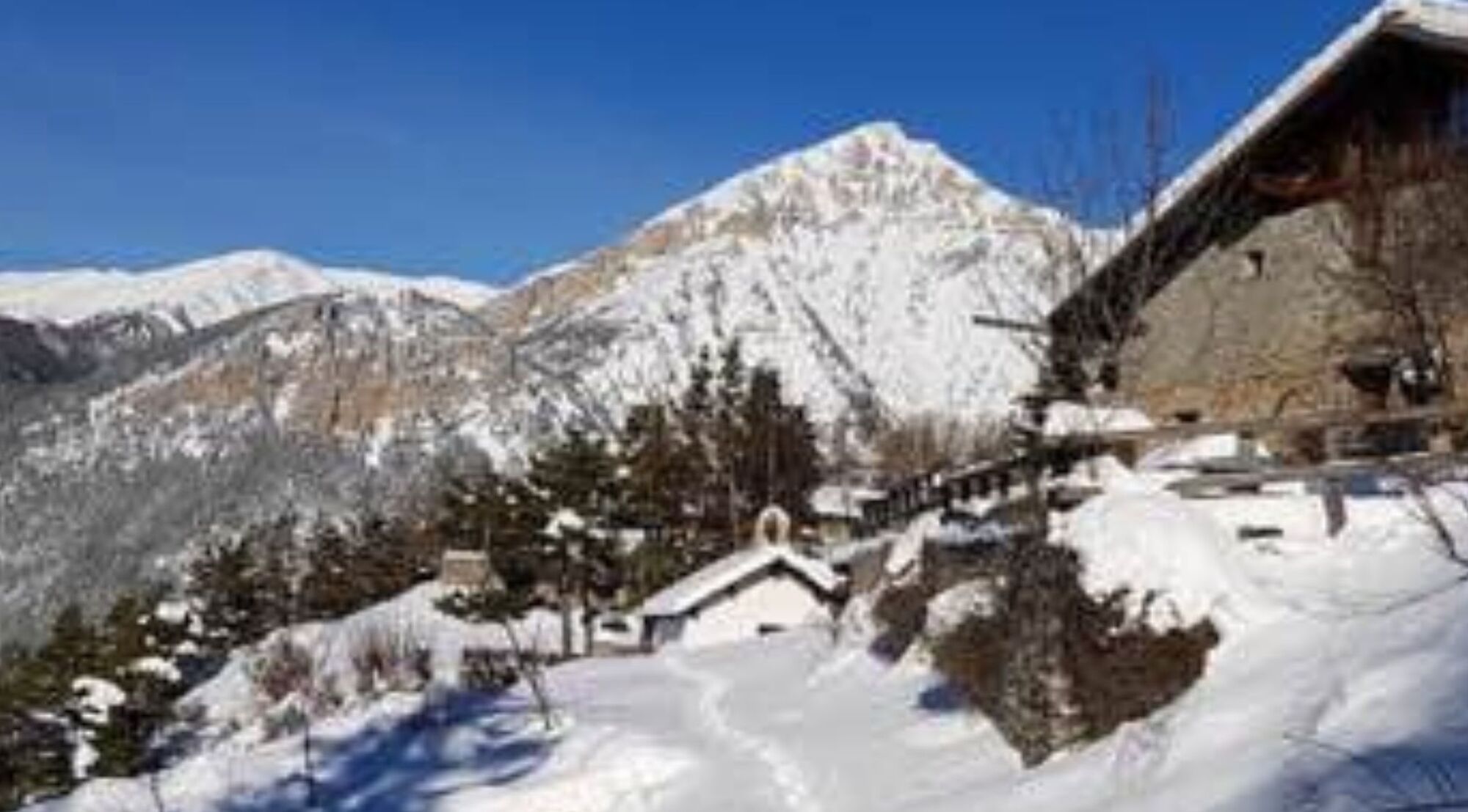
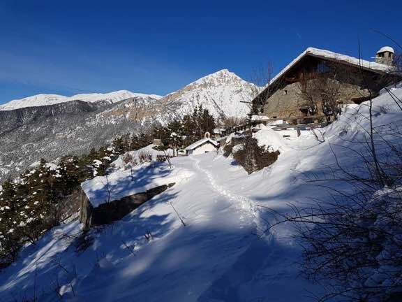
Downstream, the Rio Gran Comba bears the marks of numerous past floods; higher up the path passes by the chapel of San Domenico on an isolated sunny hill once cultivated, before reaching the village of Monfol (with the chapel of San Bartolomeo) in a privileged and panoramic position.

Park at Gad and follow the main road up to the last houses. From here, take the dirt road that continues mostly flat until you reach a small wooden bridge on your left. After crossing the bridge, continue to the right. Shortly after, the path turns left and starts to climb. Follow the track until you reach Monfol.
Áno
Clothing and footwear suitable for the winter mountain environment: snowshoes or crampons (in case of compact or icy ground) – poles – ARVA, shovel and probe.
Before undertaking any hike it is advised to:
- check the ARPA Piemonte weather and avalanche bulletins, http://www.arpa.piemonte.it/bollettini and get information at local Tourist Offices, Ski Schools or Alpine Guides.
- in case of high avalanche danger it is not recommended to undertake any excursions.
- the indicated trails are only tracked by foot traffic: there is no mechanical maintenance or grooming service, daily or periodic.
- hiking in snowy environments requires the use of electronic signaling and search systems as per Legislative Decree no. 40/2021 art. 26
- the difficulty level indicated for each route can vary depending on the conditions of the snow cover
From Turin follow signs for the North Ring Road towards Trafori - Frejus. Then take the A32 motorway towards Bardonecchia and exit at Oulx east. Continue towards Oulx and at the roundabout turn left and enter the Gad hamlet.
Train from Torino P.N to Bardonecchia (stop at Oulx-Cesana-Claviere-Sestriere).
Gad hamlet
Do not throw waste into the environment but carry it away, also picking up any left by others.
The indicated walking times are approximate and may vary depending on weather conditions and your abilities.
In case of particularly compact or icy snow it is recommended to use crampons.
This route is part of the easily accessible trail network from the Sentiero Italia.
Bring a backpack with water and food, there are no refreshment points or fountains along the route.
To shorten the route and make it less challenging, after the Chapel of San Domenico, after a little more than 400 meters, you can take the path on the right that leads to the Belvedere delle Sellette, Gran Villard, and Sauze d'Oulx.
Obľúbené výlety v okolí
-
5,0
BARDONECCHIA Colle Sommeiller
strednáMountainbike 25,4 km -
5,0
BARDONECCHIA Forte Jafferau Loop
ťažkéMountainbike 36,8 km -
5,0
BARDONECCHIA Decauville
strednáTuristika 7,29 km -
5,0
BARDONECCHIA Col des Acles - Passo della Mulattiera
strednáTuristika 6,23 km -
5,0
SESTRIERE Monte Rognosa
ťažkéTuristika 6,42 km -
BARDONECCHIA Monte Jafferau
ťažkéTuristika 11,6 km -
BARDONECCHIA - Loop Colle della Scala - Col de Montgenèvre - Colle del Sestriere
ťažkéCestný bicykel 91,9 km -
5,0
CESANA T.SE Cesana - Fenils
svetloTuristika 4,60 km -
5,0
CESANA T.SE Thures - Cima Bosco
ťažkéSnežnice 3,94 km -
4,0
BARDONECCHIA Sentiero dei Cosetti by Luciano Ferraris
svetloTuristika 3,24 km

Turistika a stopovanie


Nenechajte si ujsť ponuky a inšpiráciu na ďalšiu dovolenku
Vaša e-mailová adresa bol pridaný do poštového zoznamu.