







Quattro Denti summit (from Ramats - Chiomonte)
Úroveň náročnosti: T3
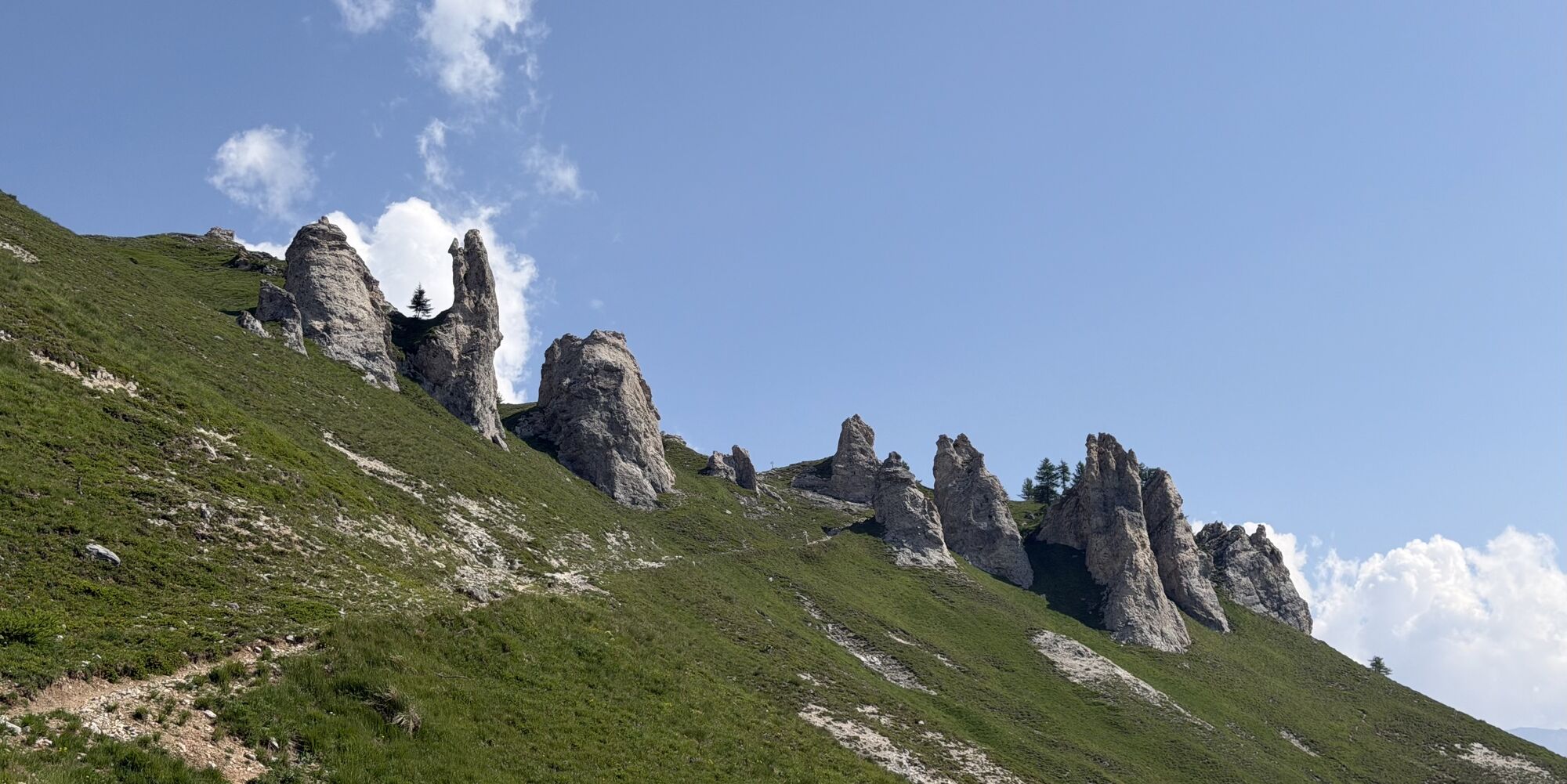
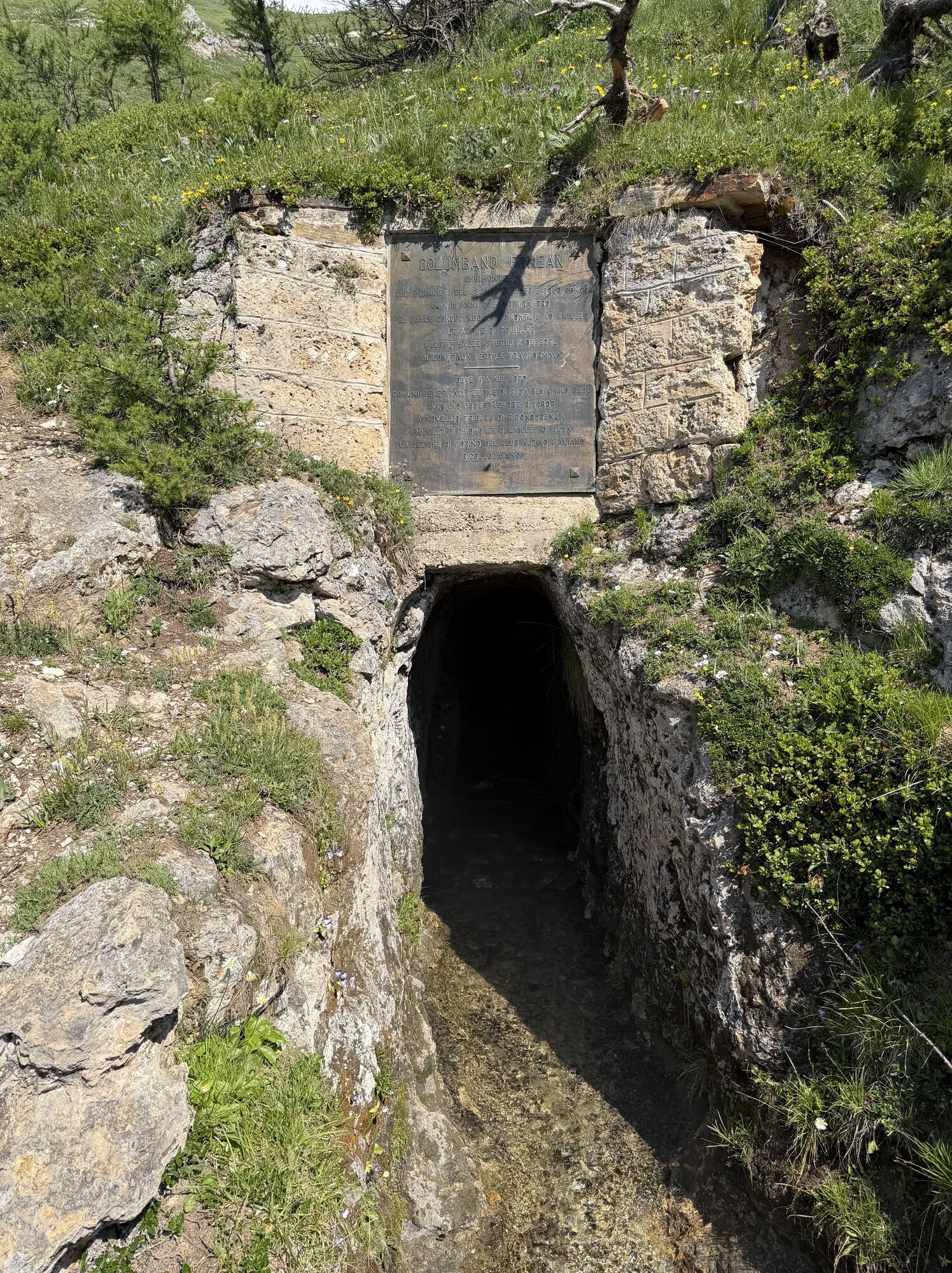
The path connects with a loop route the Ramats hamlet in the municipality of Chiomonte, with the Church of Santa Croce, the Quattro Denti summit and the famous Pertus of Colombano Romean. The hike is quite...
The path connects with a loop route the Ramats hamlet in the municipality of Chiomonte, with the Church of Santa Croce, the Quattro Denti summit and the famous Pertus of Colombano Romean. The hike is quite strenuous: constantly having to face very steep sections, both uphill and downhill, a good training is necessary.
The itinerary offers steep mule tracks bordered by dry stone walls, stretches of relaxing dirt road, ridge trail sections to walk on stones, steep slopes on alpine meadows. In the initial part the forest is a mix of broadleaf trees with prevalence of chestnut, while higher up beech and conifers appear. The long ridge section, acting as a watershed between Val Clarea and Val di Susa, as the forest thins climbing altitude, offers wonderful panoramas especially in the final part culminating at Quattro Denti where now the characteristic limestone rocks replace the crystalline rocks found lower down. On the return, the route passes in front of the legendary "Pertus" of Colombano Romean, an ancient gallery dug for water supply for Exilles and Chiomonte, adding a touch of history and legend to the hike. In the first part of the journey it is worthwhile to take a short detour to the Chapel of Santa Croce or Cappella Bianca, located in a small clearing among Scots pines and beech, equipped for picnics. Also, the characteristic hamlet Sant’Antonio of Ramats from which the itinerary starts allows a refreshing break at the bar-trattoria “Le Ciaparat”.

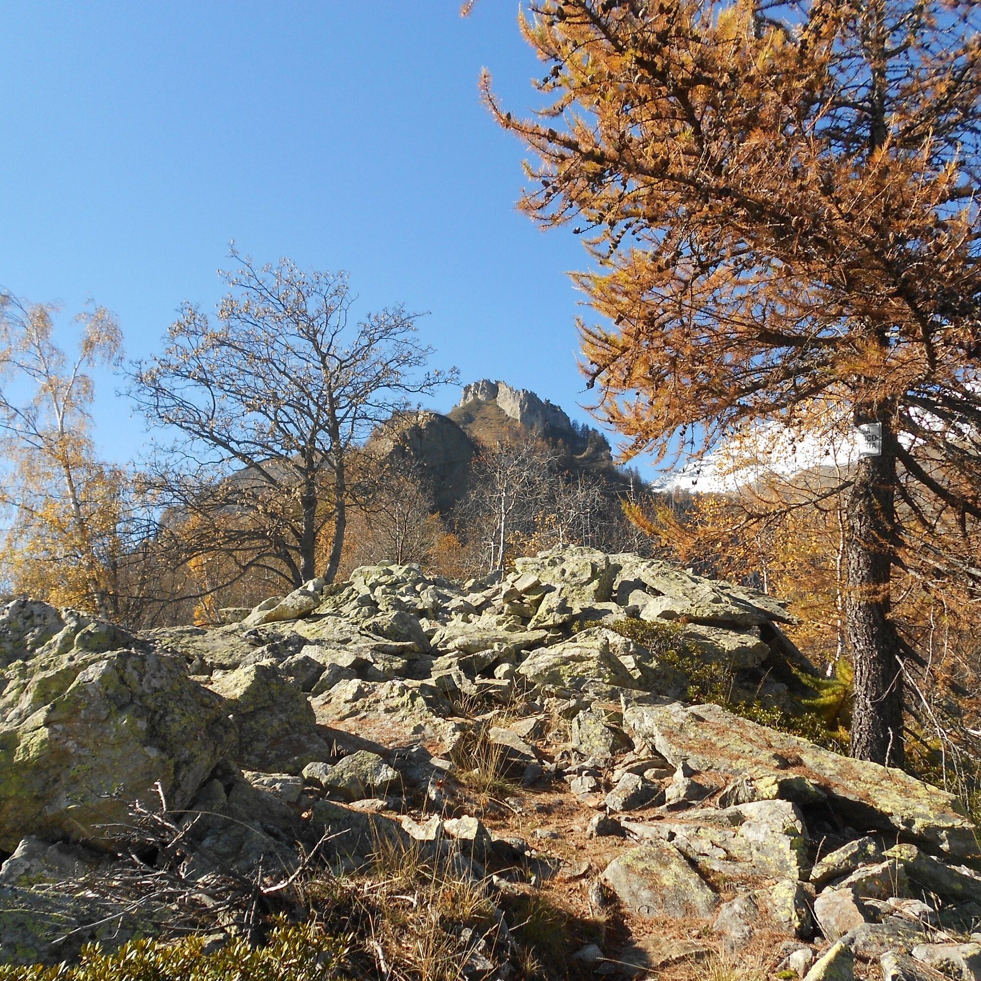

The route starts in the locality of Sant'Antonio of the Ramats hamlet, located in the municipality of Chiomonte on the left hydrographic side of the Dora Riparia. The access road is narrow, and it is not very easy to park the car as parking spaces are scarce (near the cemetery and near the church). Just before the Church located at an altitude of 997 m, on the left along with the sign for Via Colombano Romean and the Public Park, the path to Quattro Denti is indicated, but it is recommended to go beyond the church and the washhouse, and immediately take the characteristic Via Jannon to the left, which climbs narrow along the hamlet; you pass in front of a beautiful covered fountain on the left, the bar-tavern on the right, until you pass the Circle overlooking the Public Park. Here you ignore the right path indicating Cappella Bianca and Val Clarea Observatory as it is no longer maintained, to continue straight following path 810 which immediately begins to climb between dry stone walls and broadleaf trees along a steep mule track; after a sharp turn to the right, you reach at 1,200 m a semi-abandoned hut from which, continuing straight on a clear trail, you emerge on a dirt road that must be followed to the right towards Cappella Bianca; after about 150 meters the road turns left, and shortly after you reach a junction (altitude 1,235 m) from which you can see to the left the houses of Borgata Alberea; instead, proceed to the right on a slight climb following signs to Cappella Bianca; ignoring after about 300 meters a secondary path on the left, continue on the main path shortly passing under the Grange Chejrero; leave the carriageable road that leads to the hamlet to take at 1,285 m the mule track (path 808) towards Cappella Bianca, Grange Battagliera in Val Clarea, Giaglione. Among pines, broadleaf trees, and some views towards the valley, after about 400 meters you reach a new fork from which, continuing straight for another 200 meters, you finally reach the Cappella di Santa Croce (1,390 m) located in a clearing. Returning to the previous fork (it is possible to briefly climb to the observer's stone at the ridge top), continue straight starting the ridge route following path 808b for a stretch (Grange Battagliera, Pian delle Rovine, Giaglione), then leave it after about 350 meters at 1,440 m continuing on path 808 towards Quattro Denti. Having found a repeater at 1,540 m, shortly near a grove of birches around 1,570 m, you must face a more demanding section on boulders and stones, at the end of which the view begins to open on both valleys. The path continues to climb quite linearly surrounded by forest and stones, and after a small series of hairpin bends reach a stony saddle at 1,770 m from which you finally spot the rocky complex of Quattro Denti right ahead. For a stretch the path softens then steepens again reaching, after some hairpin bends, at 1,915 m where you pass near a vertical rock wall on the right, now in a very sparse forest. From here begins a traverse climb along a rather steep grassy slope, but the path is in good condition; after some hairpin bends you reach a wide grassy saddle at 2,000 m from which starts the final traverse that, passing at the foot of various limestone rock teeth, meets at 2,085 m the path coming from the left from the Pertus. Two more curves and you reach the saddle at 2,106 m (with signs for various destinations) and on the right the highest tooth of the Quattro Denti (2,108 m).
To do the loop route, back at the fork just below, instead of retracing the path on the left done on the way up, proceed straight following the signs for the Pertus (which is reached after about 400 meters with a slight descent), Grange della Valle, Salbertrand. Upon arrival at the Pertus of Colombano Romean, take the path that makes a sharp turn to the left, with signs for Ambournet and Ramats, entering again the larch forest along the steep slope. The path descends always quite steep with several hairpin bends, sometimes paved with cobblestones but always well marked, softening at times, until reaching at 1,700 meters in the forest now also populated by broadleaf trees, the junction with the path to the right that leads to Cels and Ambournet which is ignored, proceeding straight towards Case Rigaud (reached after about 850 meters) and Ramats. Upon reaching the now semi-abandoned Grange Rigaud (1,460 m) ignore the path to the right and proceed along the carriageable road, crossing a couple of times a slope protected by wooden avalanche barriers. Ignoring the signs for the paths and always proceeding on the carriageable road, after some hairpin bends you reach the Grange Alberea (a nice cluster of restored huts) at an altitude of 1,245 m where a fountain is present. At the entrance of the hamlet, opposite the fountain, the path no. 810a descends to the right with destination Ramats (S. Antonio) and Salbertrand, which is taken; shortly after you cross the carriageable road and, still following path 810a, you skirt on the left the ruin of the hut located at 1,200 m encountered at the start of the excursion; from here you retrace the same path done on the way up which in less than 1 km leads back to the Church of Sant'Antonio.
Áno
Áno
Wear clothing and footwear suitable for the environment and season.
On the ridge at about 1,570 m the path seems to get lost among boulders and stones among the birches: the short uphill stretch is tackled on the rocks sometimes using hands to aid balance; in any case, there is no exposure and some cairns indicate the passage.
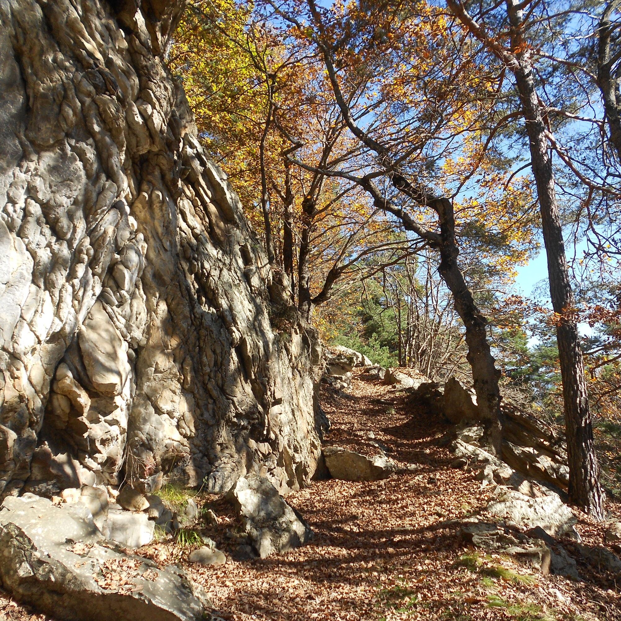
The itinerary takes place at relatively low altitudes characterized by the presence of broadleaf trees: in autumn, pay attention to the thick layer of leaves that hides possible irregularities on the ground that may be present along the path.
From Turin, follow signs for the Tangenziale Nord E70 towards Trafori - Frejus. Take the A32 highway towards Bardonecchia and
- exit the highway at Susa and travel the SS24 road towards Chiomonte and then to the Ramats hamlet for about 14 km
- exit the highway at Oulx. Keep right and travel the SS24 road towards the Ramats hamlet for about 18 km
Park without obstructing traffic and private properties near the start of the itinerary.
T3
Before undertaking any hike it is advisable to check weather bulletins or ask for information at local Tourism Offices. It is good practice not to hike alone and always inform someone of your destination.
Do not litter but carry out waste with you, possibly collecting others left behind.
The indicated travel times are approximate and may vary depending on weather conditions and personal ability.
Active fountain in the locality of Grange Alberea. The fountain of Case Rigaud was not active during the inspection carried out in November 2024.
In the section between Case Rigaud and Case Alberea it was preferred to walk with ease on the carriageable road as the paths cutting the hairpins might be not very frequently used or constantly checked.
Obľúbené výlety v okolí
-
4,5
Rocciamelone partedjo dalla Riposa. Mompantero, Piemont/Italien
strednáTuristika 10,6 km -
5,0
BARDONECCHIA Colle Sommeiller
strednáMountainbike 25,4 km -
5,0
BARDONECCHIA Forte Jafferau Loop
ťažkéMountainbike 36,8 km -
4,5
Hiking at Lake Clair
ťažkéTuristika 6,99 km -
BARDONECCHIA Monte Jafferau
ťažkéTuristika 11,6 km -
SAUZE D'OULX Richardette - Montagne Seu )
strednáMountainbike 19,9 km -
BARDONECCHIA Rochemolles Dam - Scarfiotti Refuge
strednáTuristika 7,77 km -
OULX Borgata Seu (Gran Bosco Natural Park)
svetloSnežnice 5,93 km -
5,0
OULX Montagne Seu
svetloTuristika 5,28 km -
PRAGELATO Colle dell'Assietta
ťažkéMountainbike 53,3 km
Turistika a stopovanie


Nenechajte si ujsť ponuky a inšpiráciu na ďalšiu dovolenku
Vaša e-mailová adresa bol pridaný do poštového zoznamu.





