Snowshoe trekking Plateau D'Anelle
stredná
Získajte túto prehliadku v mobilnom telefóne
Snowshoe trekking Plateau D'Anelle
stredná
Snežnice
7,51
km
Naskenujte kód QR a spustite navigáciu v aplikácii bergfex

Turistika a stopovanie


Snowshoe trekking Plateau D'Anelle
stredná
Vzdialenosť
7,51
km
Trvanie
03:30
h
Ascent
287
hm
Hladina mora
1 473 -
1 772
m
Stiahnutie skladby
Snowshoe trekking Plateau D'Anelle
stredná
Snežnice
7,51
km
Elevation gain: +380 meters / - 380 meters
Distance: 7.5 kilometers
Duration: 3 hours 30
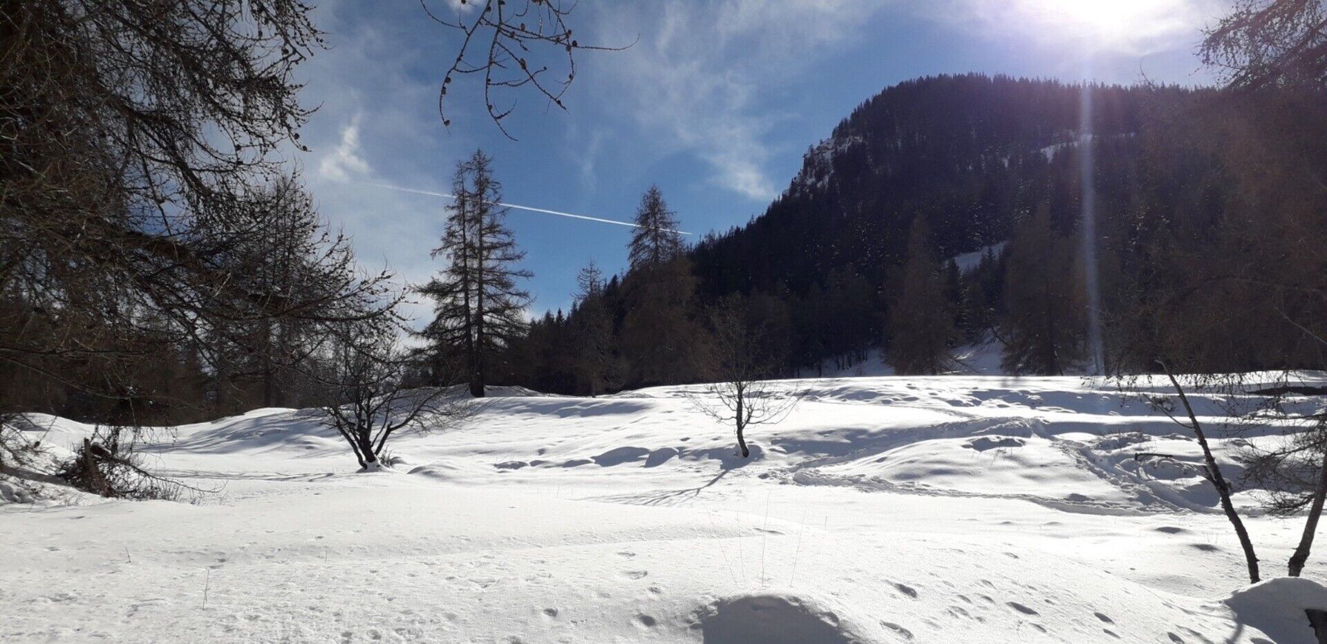
Recommended period: December to March
Avalanche risk depending on conditions: Requiring
Cartography: TOP 25 n° 3639 OT
Itinerary...
Opis
Elevation gain: +380 meters / - 380 meters
Distance: 7.5 kilometers
Duration: 3 hours 30
Recommended period: December to March
Avalanche risk depending on conditions: Requiring
Cartography: TOP 25 n° 3639 OT
Itinerary :
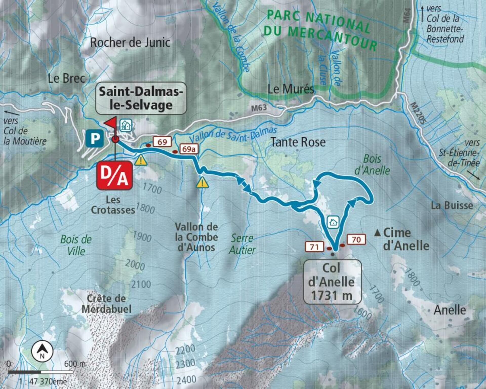
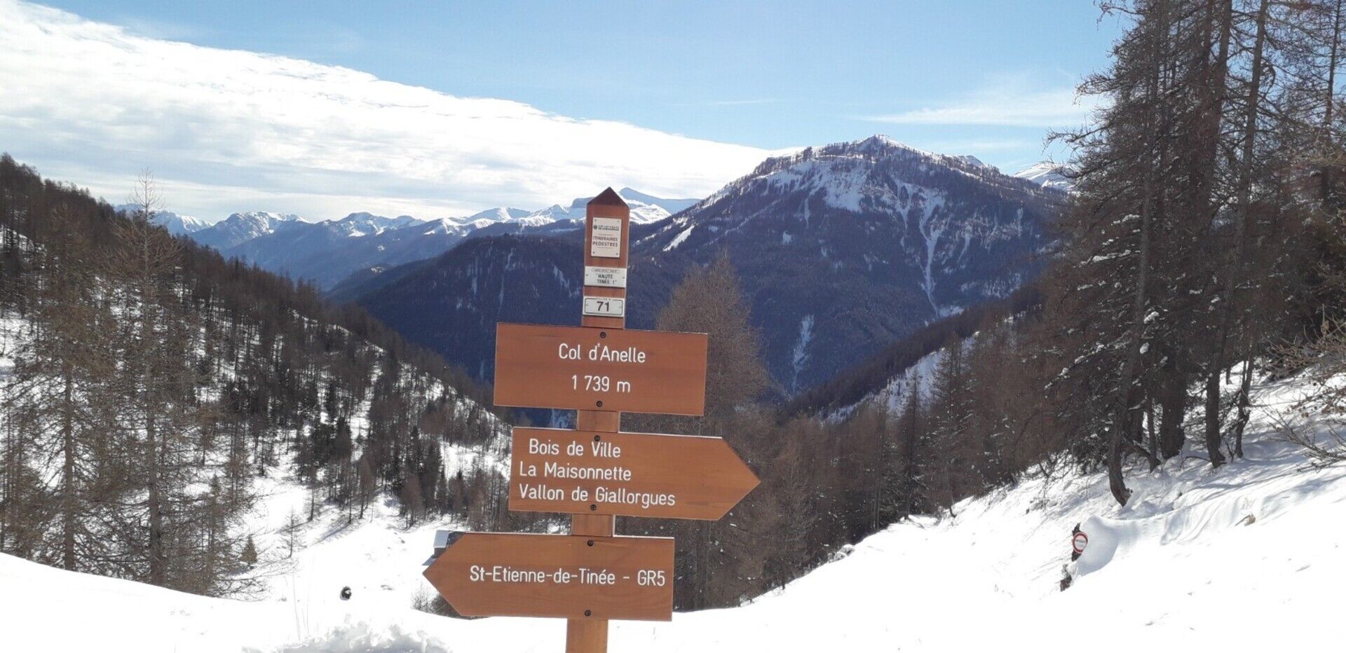
From the village car park (1,500 m), go down under the church and cross the valley of Saint-Dalmas-le-Selvage on a stone bridge (1,476 m); go up towards the south-east the wide forest track marked with GR® which leads to the Anelle pass (1,739 m - b.71) via markers 69, 69a and 70.
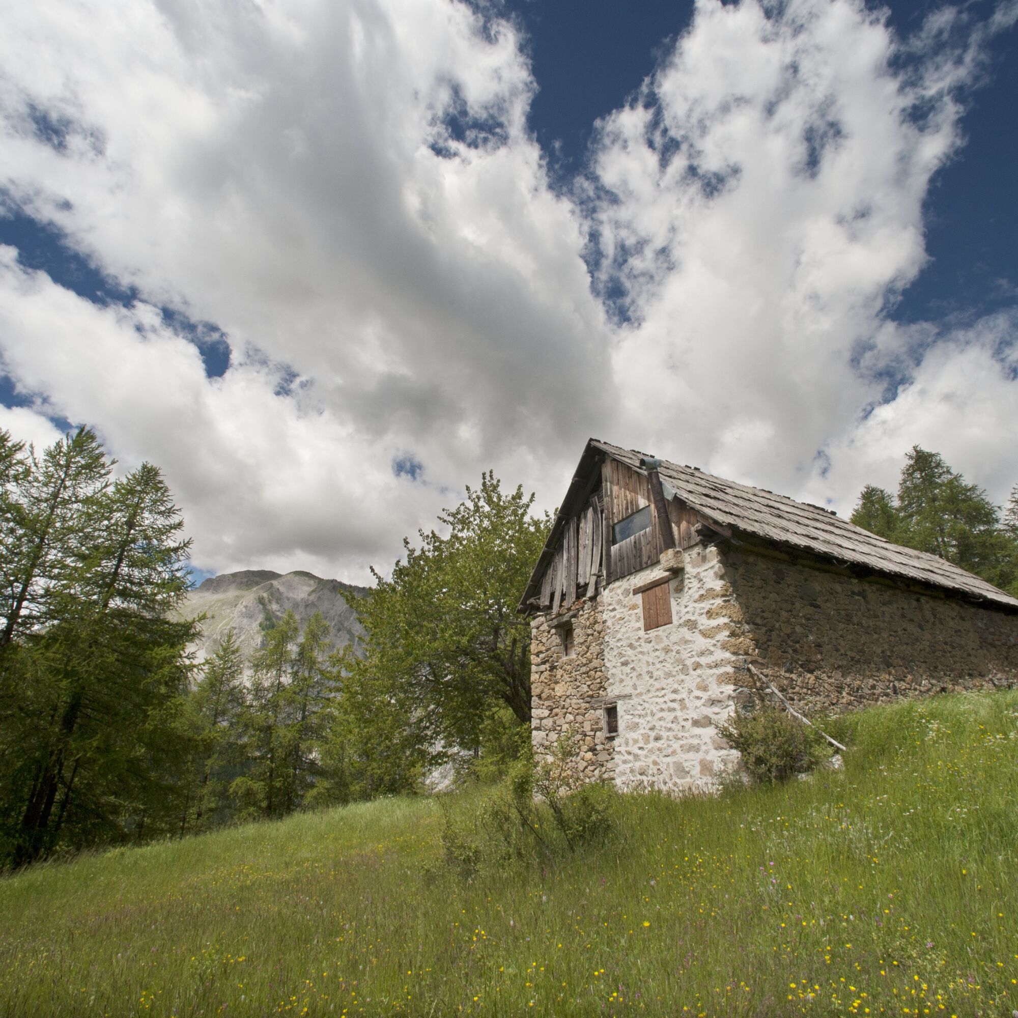
Admire as you pass the alpine barns whose only roof emerges in heavy snow. From the pass, a beautiful escape to the Auron ski area and Mont Mounier, with the possibility of shelter nearby in a wooden cabin always open, located on a small hill to the left of the pass.
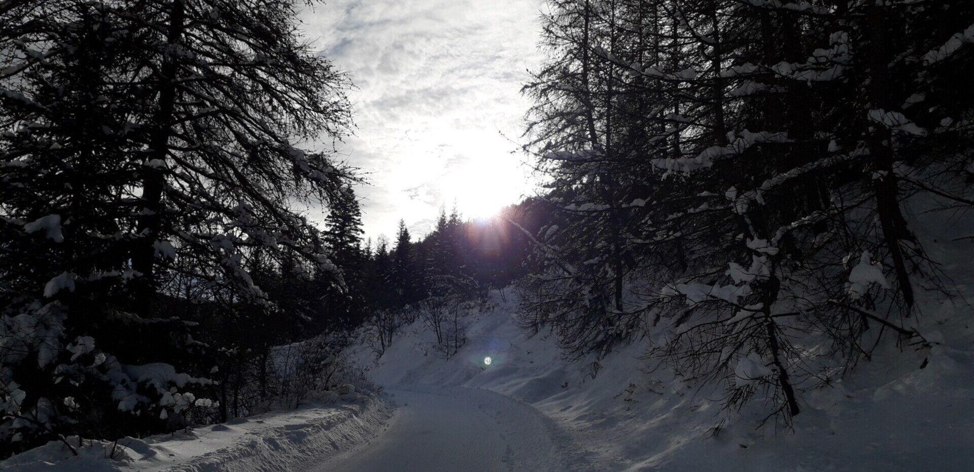
Continue on a track due north in a slight uphill climb to a small pass (1,780 m) and begin (east) the descent into the Anelle woods. Having reached a small clearing (“belvédère de la Tinée”), make a wide movement from right to left to reach the crossed barns on the way up.
Return to Saint-Dalmas-le-Selvage via the route taken on the outward journey.
Distance: 7.5 kilometers
Duration: 3 hours 30
Recommended period: December to March
Avalanche risk depending on conditions: Requiring
Cartography: TOP 25 n° 3639 OT
Itinerary :
From the village car park (1,500 m), go down under the church and cross the valley of Saint-Dalmas-le-Selvage on a stone bridge (1,476 m); go up towards the south-east the wide forest track marked with GR® which leads to the Anelle pass (1,739 m - b.71) via markers 69, 69a and 70.
Admire as you pass the alpine barns whose only roof emerges in heavy snow. From the pass, a beautiful escape to the Auron ski area and Mont Mounier, with the possibility of shelter nearby in a wooden cabin always open, located on a small hill to the left of the pass.
Continue on a track due north in a slight uphill climb to a small pass (1,780 m) and begin (east) the descent into the Anelle woods. Having reached a small clearing (“belvédère de la Tinée”), make a wide movement from right to left to reach the crossed barns on the way up.
Return to Saint-Dalmas-le-Selvage via the route taken on the outward journey.
Trasa
Saint-Dalmas-le-Selvage
(1 510 m)
Dedina
0,0 km
Abri d'Anelle
(1 744 m)
Útočisko (nespravované)
3,2 km
Saint-Dalmas-le-Selvage
(1 510 m)
Dedina
7,3 km
Trasa
Snowshoe trekking Plateau D'Anelle
stredná
Snežnice
7,51
km
Autor
Poskytuje Metropole Nizza Côte d'Azur
Prehliadku Snowshoe trekking Plateau D'Anelle zabezpečuje outdooractive.com.
Informácie o trase
Jednosmerná prehliadka
Áno
Zatiaľ žiadne recenzie
Obľúbené výlety v okolí
-
4,5
Col de Larche - Lac du Lauzanier, France
svetloTuristika 13,7 km -
5,0
eBike MNCA stage 2: St-Dalmas-Le-Selvage - St-Etienne-de-Tinée
strednáMountainbike 43,2 km -
5,0
Col de la Cayolle - circuit des lacs, Frankrijk
strednáTuristika 10,8 km -
4,0
Goldtoni - Alpenbogen A078 Bousiéyas-Roya
strednádiaľková pešia trasa 31,3 km -
FFC cycling circuit no. 33: the Tinée cycle path
svetloCestný bicykel 29,4 km -
Mountain Bike FFC circuit no. 37: Col d'Anelle
ťažkéMountainbike 11,2 km -
Discovering the Natura 2000 site "Bat site of the Haute-Tinée" - starting from St Etienne de Tinée (sporting level)
strednáTuristika 7,43 km -
Snowshoe trekking La cabane de la Braisse
ťažkéSnežnice 10,9 km -
eBike MNCA stage 1: Auron - Saint-Dalmas-le-Selvage
strednáMountainbike 29,8 km -
MTB FFC circuit no. 38: Col de la Moutière / Bonette summit
ťažkéMountainbike 37,2 km
Turistika a stopovanie

Viac ako 550.000 návrhov výletov, podrobné mapy a intuitívny plánovač trás robia z aplikácie povinnú výbavu pre všetkých nadšencov prírody.

Nenechajte si ujsť ponuky a inšpiráciu na ďalšiu dovolenku
Prihlásiť sa k odberu noviniek
Chyba
Vyskytla sa chyba. Prosím, skúste to znova.
Ďakujeme za vašu registráciu
Vaša e-mailová adresa bol pridaný do poštového zoznamu.
Zájazdy po celej Európe
Rakúsko
Švajčiarsko
Nemecko
Taliansko
Slovinsko
Francúzsko
Holandsko
Belgicko
Poľsko
Lichtenštajnsko
Česko
Slovensko
španielsko
Hrvaška
Bosna a Hercegovina
Luxembursko
Andorra
Portugalsko
Island
Spojené kráľovstvo
Írsko
Grécko
Albánsko
Severné Macedónsko
Malta
Nórsko
Čierna Hora
Moldavsko
Kosovo
Maďarsko
San Maríno
Rumunsko
Estónsko
Lotyšsko
Bielorusko
Cyprus
Litva
Srbsko
Bulharsko
Monako
Dánsko
Švédsko
Fínsko