Snowshoe trekking La cabane de la Braisse
ťažké
Získajte túto prehliadku v mobilnom telefóne
Snowshoe trekking La cabane de la Braisse
ťažké
Snežnice
10,89
km
Naskenujte kód QR a spustite navigáciu v aplikácii bergfex

Turistika a stopovanie


Snowshoe trekking La cabane de la Braisse
ťažké
Vzdialenosť
10,89
km
Trvanie
05:00
h
Ascent
630
hm
Hladina mora
1 502 -
2 170
m
Stiahnutie skladby
Snowshoe trekking La cabane de la Braisse
ťažké
Snežnice
10,89
km
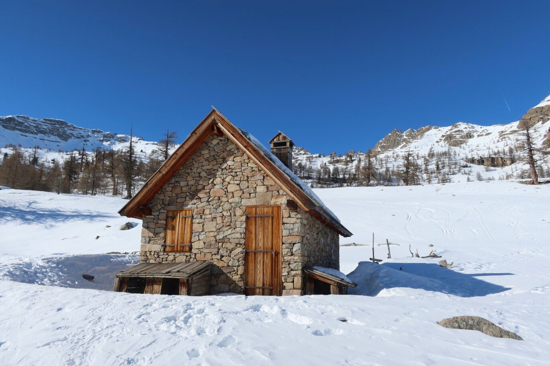
This hike offers a comfortable route in the best snow-covered sector of Haute Tinée with the theme of interest being the centuries-old larch tree of La Braisse and the pastoral hut built in 2001.
On this...
Opis
This hike offers a comfortable route in the best snow-covered sector of Haute Tinée with the theme of interest being the centuries-old larch tree of La Braisse and the pastoral hut built in 2001.
On this route, the Mercantour National Park wanted to promote the tranquility of black grouse during winter. Marking has been put in place encouraging you to go around the quiet areas. Please respect it and thus contribute to the survival of this species during the winter.
Elevation gain: +720 meters / -720 meters
Distance: 11 kilometers AR
Duration: 4 hours
Recommended period: December to April
Avalanche risk depending on conditions: Requiring
Cartography: TOP 25 n° 3639 OT
Regulations: Mercantour National Park
Itinerary :
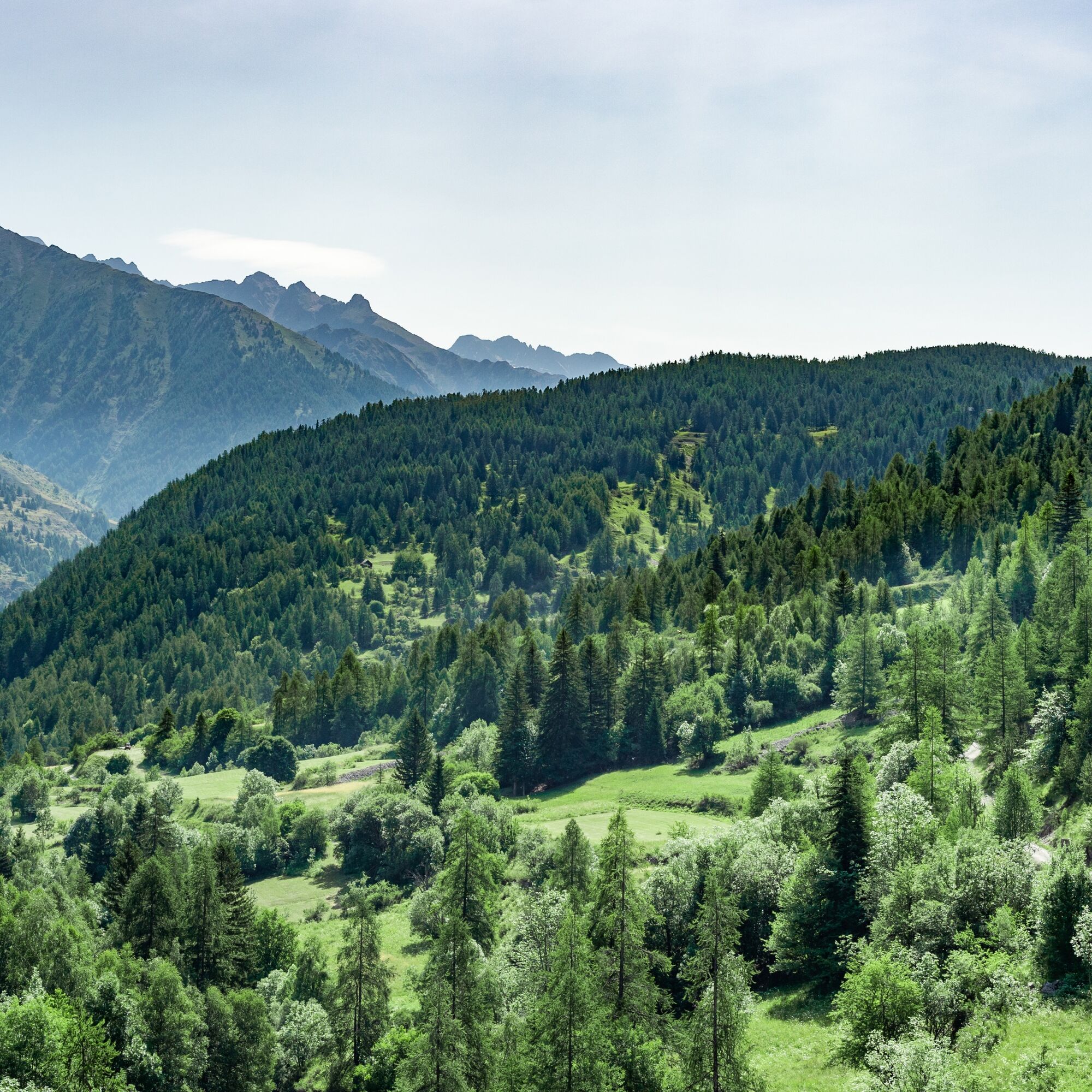
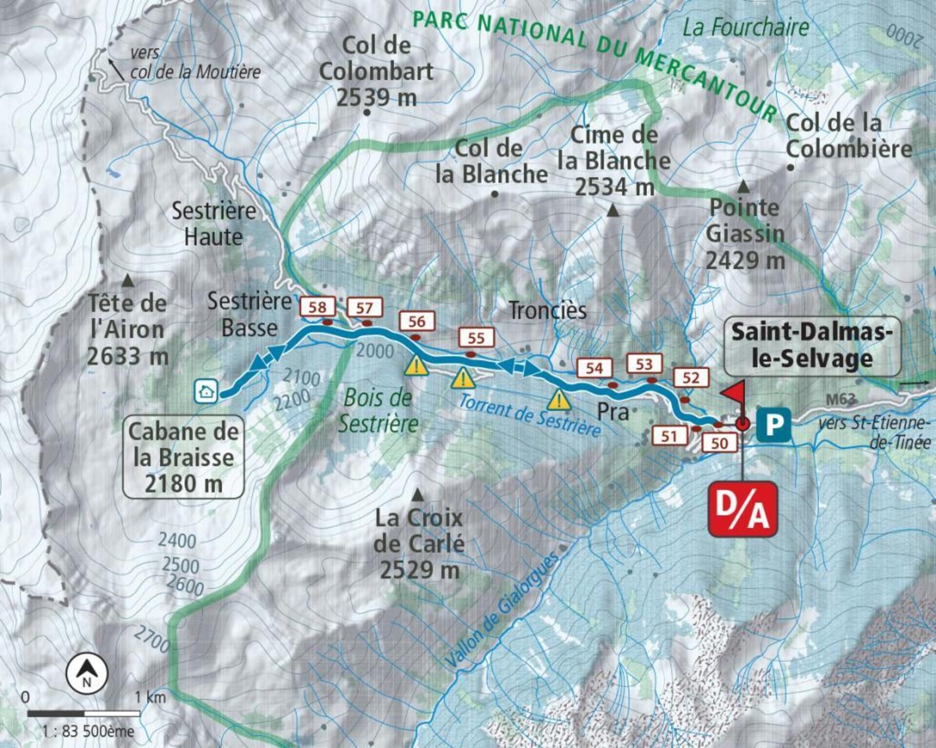
From the village car park, follow (b.50) the path which cuts the bends of the Sestrière road (b.51); continue on this for approximately 500 m before again avoiding three bends via markers 52, 53 and 54.
Then walk on the route of the road to cut further a final bend (b.55, 56) at the level of the avalanche corridors coming from the Croix de Carlé; we soon reach the footbridge over the Braisse valley which we cross just before the Sestrière plateau.
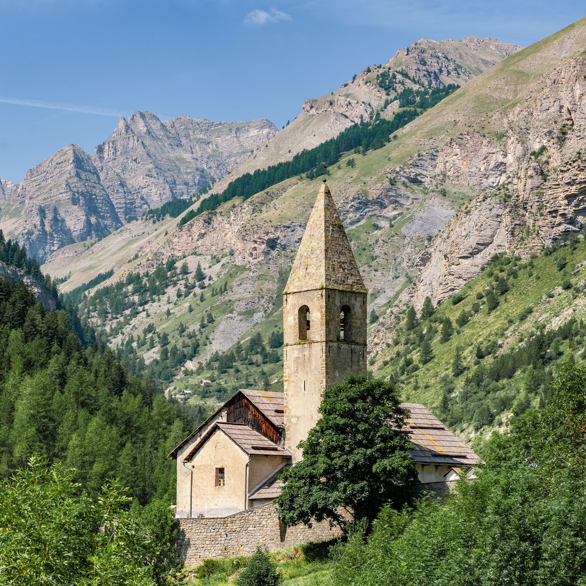
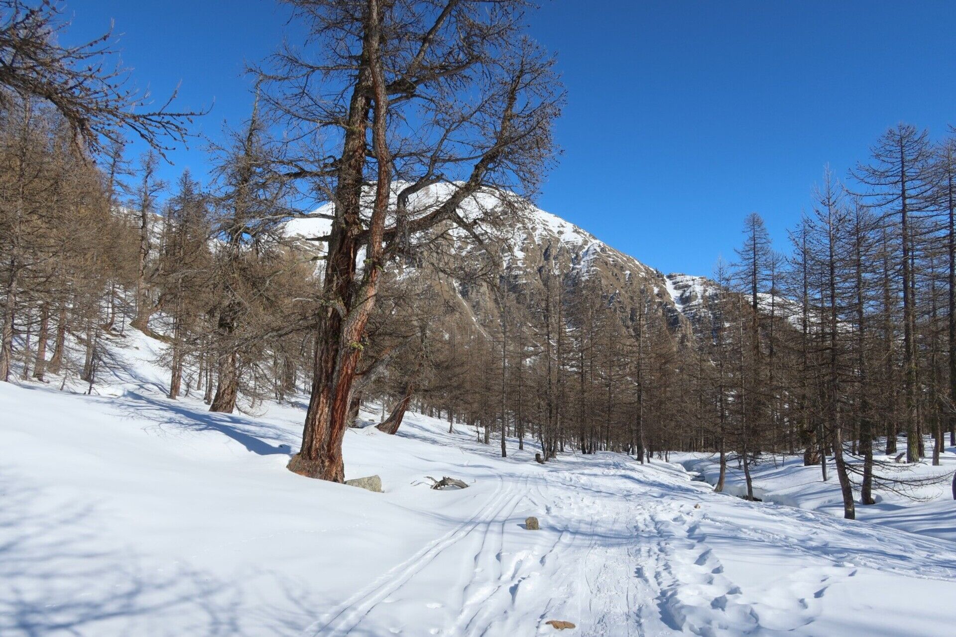
Go up to the left (b.57) the wide and placid valley of La Braisse (south-west), and let yourself be carried by the moderate slopes which lead to the closed pastoral cabin (2,180 m), just above the the head of Cristel (2,726 m). Go back down as you wish among the gigantic larches to the Sestrière plateau (2,000 m) where you find the road to the Col de la Moutière.
Follow this to the village or cut the last bends using the uphill shortcuts.
On this route, the Mercantour National Park wanted to promote the tranquility of black grouse during winter. Marking has been put in place encouraging you to go around the quiet areas. Please respect it and thus contribute to the survival of this species during the winter.
Elevation gain: +720 meters / -720 meters
Distance: 11 kilometers AR
Duration: 4 hours
Recommended period: December to April
Avalanche risk depending on conditions: Requiring
Cartography: TOP 25 n° 3639 OT
Regulations: Mercantour National Park
Itinerary :
From the village car park, follow (b.50) the path which cuts the bends of the Sestrière road (b.51); continue on this for approximately 500 m before again avoiding three bends via markers 52, 53 and 54.
Then walk on the route of the road to cut further a final bend (b.55, 56) at the level of the avalanche corridors coming from the Croix de Carlé; we soon reach the footbridge over the Braisse valley which we cross just before the Sestrière plateau.
Go up to the left (b.57) the wide and placid valley of La Braisse (south-west), and let yourself be carried by the moderate slopes which lead to the closed pastoral cabin (2,180 m), just above the the head of Cristel (2,726 m). Go back down as you wish among the gigantic larches to the Sestrière plateau (2,000 m) where you find the road to the Col de la Moutière.
Follow this to the village or cut the last bends using the uphill shortcuts.
Trasa
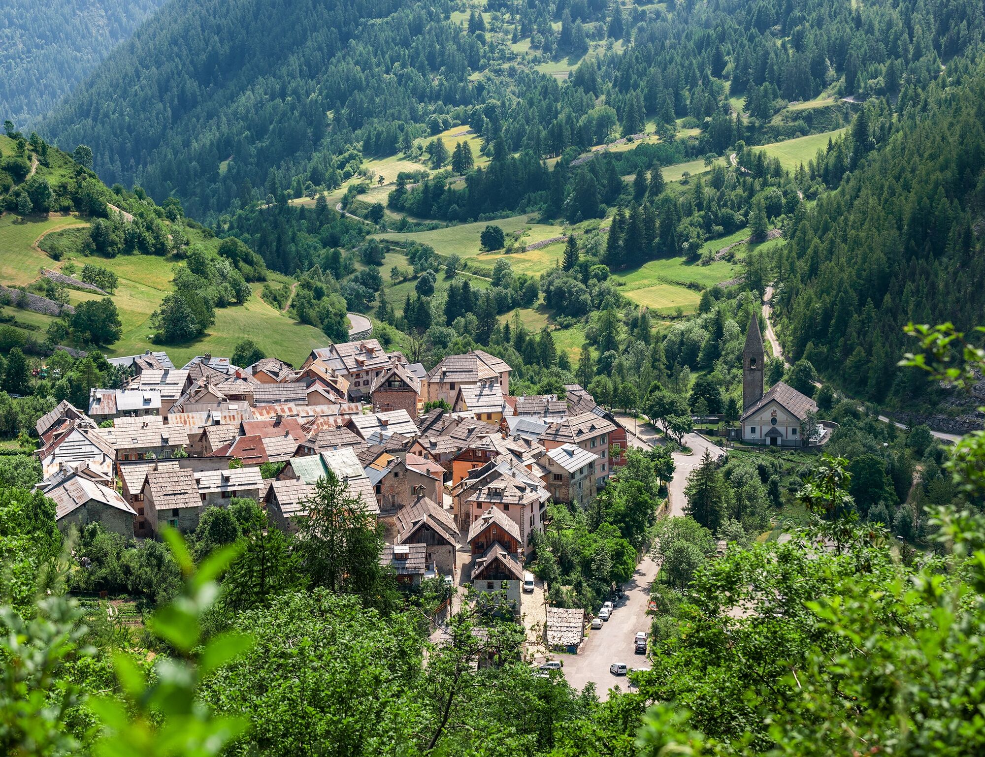
Saint-Dalmas-le-Selvage
(1 510 m)
Dedina
0,0 km
Sestrière Basse
(2 008 m)
Zúčtovanie
6,6 km
Saint-Dalmas-le-Selvage
(1 510 m)
Dedina
10,9 km
Trasa
Snowshoe trekking La cabane de la Braisse
ťažké
Snežnice
10,89
km
Autor
Poskytuje Metropole Nizza Côte d'Azur
Prehliadku Snowshoe trekking La cabane de la Braisse zabezpečuje outdooractive.com.
Informácie o trase
Jednosmerná prehliadka
Áno
Zatiaľ žiadne recenzie
Obľúbené výlety v okolí
-
4,5
Col de Larche - Lac du Lauzanier, France
svetloTuristika 13,7 km -
5,0
eBike MNCA stage 2: St-Dalmas-Le-Selvage - St-Etienne-de-Tinée
strednáMountainbike 43,2 km -
5,0
Col de la Cayolle - circuit des lacs, Frankrijk
strednáTuristika 10,8 km -
4,0
Goldtoni - Alpenbogen A078 Bousiéyas-Roya
strednádiaľková pešia trasa 31,3 km -
5,0
Goldtoni - Alpenbogen A077 Refugium Campo-Bousieyas
strednádiaľková pešia trasa 34,1 km -
FFC cycling circuit no. 33: the Tinée cycle path
svetloCestný bicykel 29,4 km -
Mountain Bike FFC circuit no. 37: Col d'Anelle
ťažkéMountainbike 11,2 km -
Discovering the Natura 2000 site "Bat site of the Haute-Tinée" - starting from St Etienne de Tinée (sporting level)
strednáTuristika 7,43 km -
eBike MNCA stage 1: Auron - Saint-Dalmas-le-Selvage
strednáMountainbike 29,8 km -
Snowshoe trekking Plateau D'Anelle
strednáSnežnice 7,51 km
Turistika a stopovanie

Viac ako 550.000 návrhov výletov, podrobné mapy a intuitívny plánovač trás robia z aplikácie povinnú výbavu pre všetkých nadšencov prírody.

Nenechajte si ujsť ponuky a inšpiráciu na ďalšiu dovolenku
Prihlásiť sa k odberu noviniek
Chyba
Vyskytla sa chyba. Prosím, skúste to znova.
Ďakujeme za vašu registráciu
Vaša e-mailová adresa bol pridaný do poštového zoznamu.
Zájazdy po celej Európe
Rakúsko
Švajčiarsko
Nemecko
Taliansko
Slovinsko
Francúzsko
Holandsko
Belgicko
Poľsko
Lichtenštajnsko
Česko
Slovensko
španielsko
Hrvaška
Bosna a Hercegovina
Luxembursko
Andorra
Portugalsko
Island
Spojené kráľovstvo
Írsko
Grécko
Albánsko
Severné Macedónsko
Malta
Nórsko
Čierna Hora
Moldavsko
Kosovo
Maďarsko
San Maríno
Rumunsko
Estónsko
Lotyšsko
Bielorusko
Cyprus
Litva
Srbsko
Bulharsko
Monako
Dánsko
Švédsko
Fínsko