
Hiking La croix du Collet
ťažké
Získajte túto prehliadku v mobilnom telefóne
Hiking La croix du Collet
ťažké
Snežnice
5,87
km
Naskenujte kód QR a spustite navigáciu v aplikácii bergfex


Turistika a stopovanie



Hiking La croix du Collet
ťažké
Vzdialenosť
5,87
km
Trvanie
04:00
h
Ascent
373
hm
Hladina mora
1 516 -
1 855
m

Naviguj sa počas prehliadky v aplikácii
Nainštalujte si aplikáciu zadarmo a sledujte trasu vďaka GPS navigácii a sledovaniu polohy.
Využite službu „ bergfex “ už teraz v aplikácii
Naskenuj QR kód pomocou fotoaparátu
Ak máte aplikáciu nainštalovanú, obsah sa otvorí priamo. Ak aplikáciu ešte nemáte, budete presmerovaní na stránku, kde si ju môžete bezplatne stiahnuť.
Stiahnutie skladby
Hiking La croix du Collet
ťažké
Snežnice
5,87
km
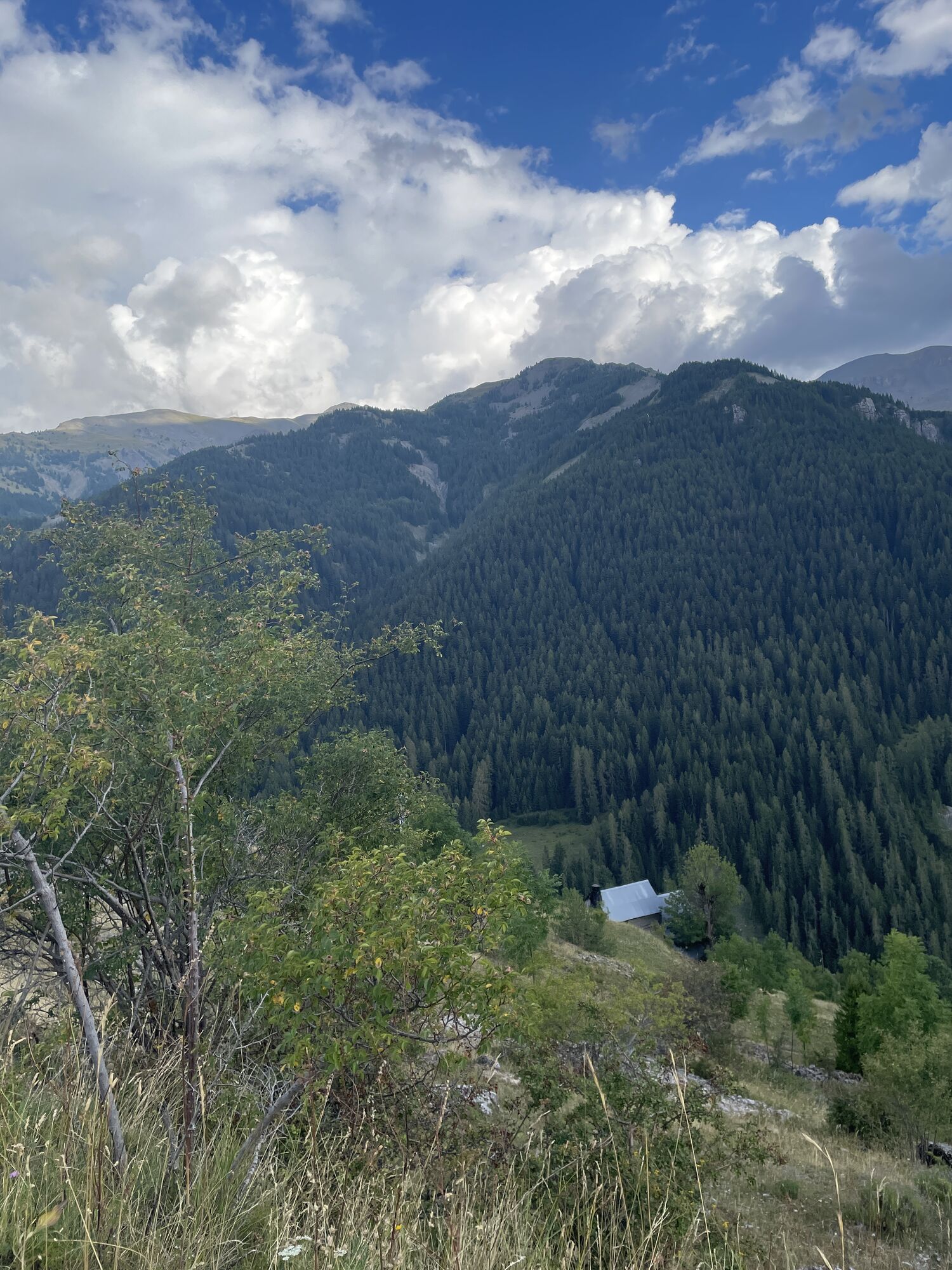
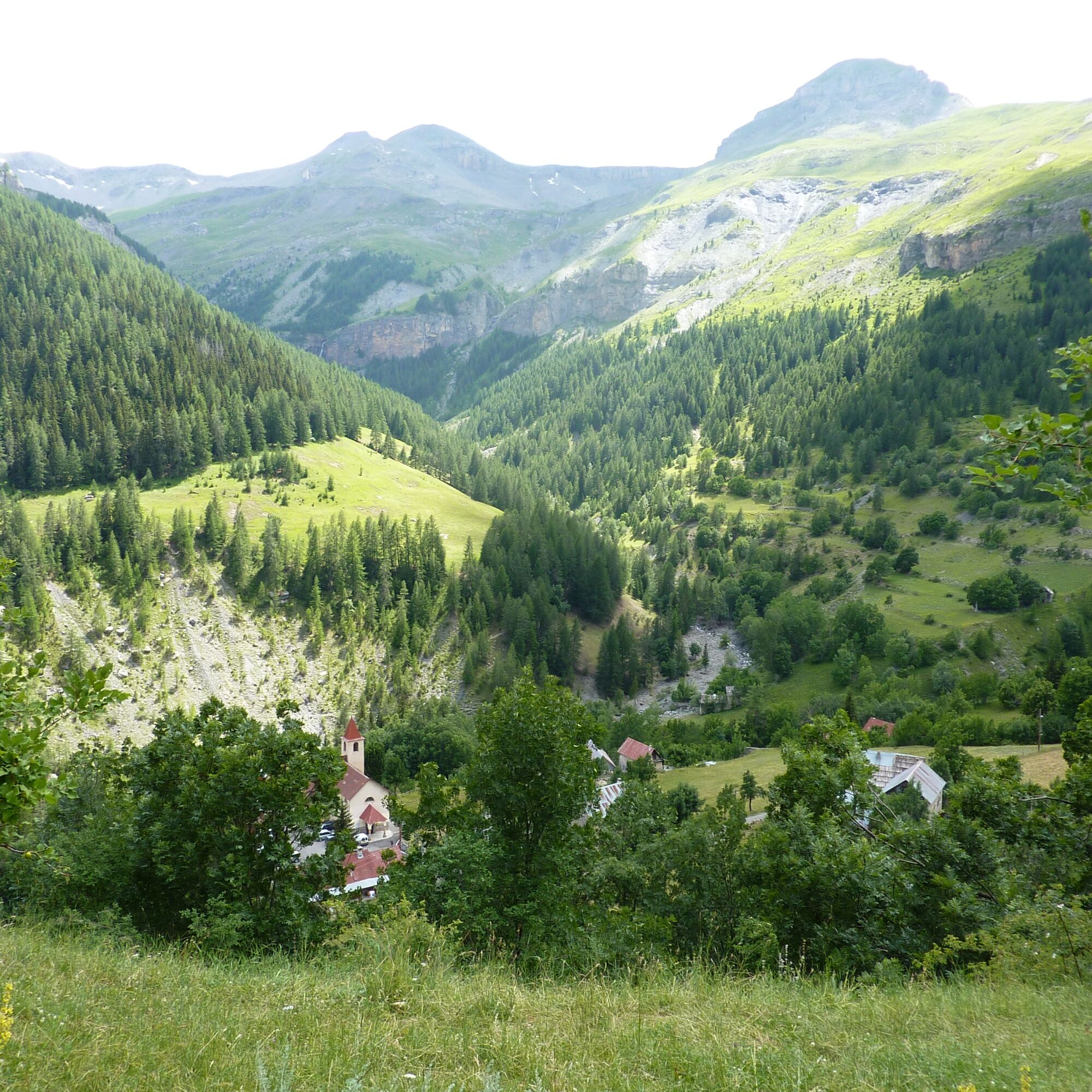
Peaceful stone barns clad in lime and larch cladding roofs mark the initial climb towards the Saint-Sébastien chapel and its bell tower restored in 2012. The impromptu arrival at the collar cross allows...
Opis
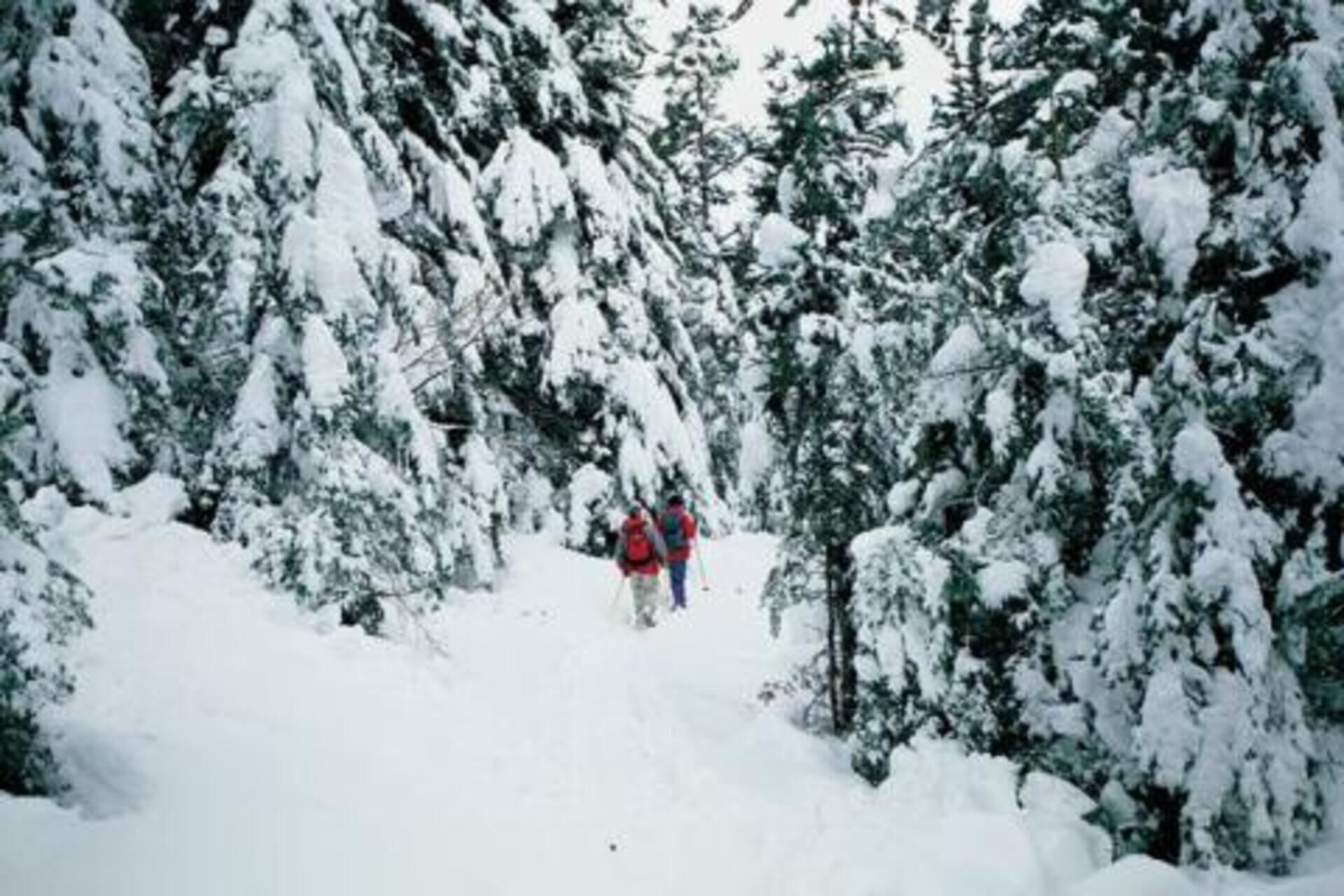
Peaceful stone barns clad in lime and larch cladding roofs mark the initial climb towards the Saint-Sébastien chapel and its bell tower restored in 2012. The impromptu arrival at the collar cross allows the discovery of a magnificent panorama which extends to the south over the Mercantour National Park and in particular the ridge of Mont Mounier, Peyre de Vic and Mont Rougnous, which is articulated on both sides another from the Sallevieille valley whose gentle snowy slopes inspire contemplation. Note that the area visited is a wintering place for ungulates; it will not be uncommon to observe chamois, deer or wild boar there.
Elevation gain: +430 meters / -430 meters
Distance: 6 kilometers round trip
Duration: 4 hours
Recommended period: December to March
Avalanche risk depending on conditions: Simple
Cartography: TOP 25 n° 3639 OT
Itinerary :
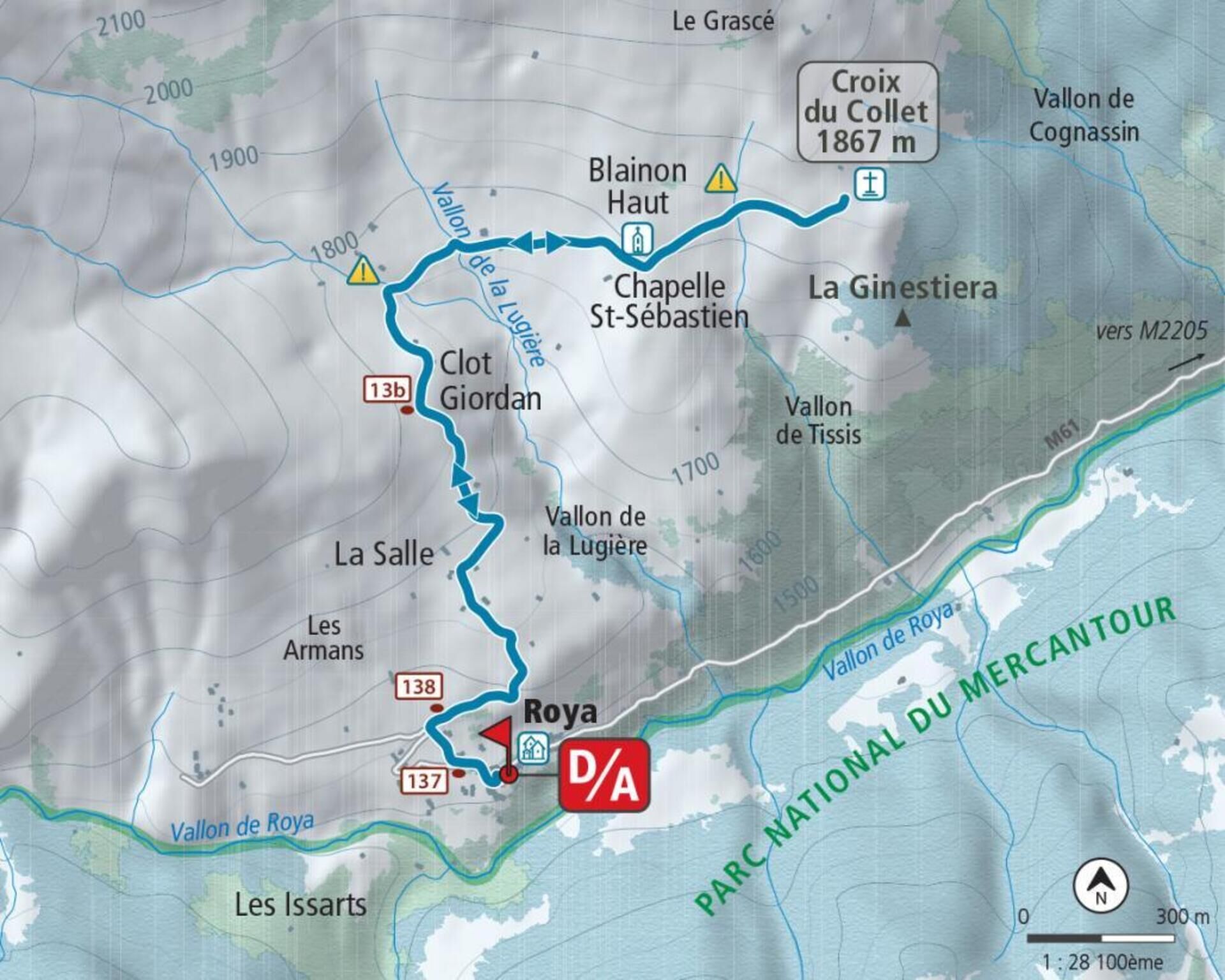
From the place of the hamlet of Roya (1,500 m - b.137) take the small road behind the stopover lodge, to find the path which goes up between the houses until reaching marker 138. Continue by turning right direction the Col du Blainon, and gradually rise to the La Salle plateau and its characteristic barns (1,667 m).
Shortly after, the route arrives at a place called “Clot Giordan” (1,779 m - b.13b); the trace of the snowy path goes off the slope and joins the Lugière valley, which you will have to cross quickly without parking to avoid exposing yourself to the dominant slopes. By a large movement turning towards the east, reach the chapel of Saint-Sébastien (bell tower) and continue in an easterly direction to easily reach the ridge of the collar and its cross (1,867 m), the high point of the route .
The return takes place via the route taken on the outward journey.
Trasa
Chapelle Saint-Roch
(1 505 m)
Miesto uctievania
0,0 km
Roya
(1 505 m)
Zúčtovanie
0,0 km
Salos
(1 674 m)
Koridor/terén
0,9 km
Trasa
Hiking La croix du Collet
ťažké
Snežnice
5,87
km
Chapelle Saint-Roch
(1 505 m)
Miesto uctievania
0,0 km
Roya
(1 505 m)
Zúčtovanie
0,0 km
Gîte de Roya
(1 512 m)
Reštaurácia
0,0 km
Salos
(1 674 m)
Koridor/terén
0,9 km
Clot-Giordan
(1 774 m)
Koridor/terén
4,3 km
Salos
(1 674 m)
Koridor/terén
5,0 km
Gîte de Roya
(1 512 m)
Reštaurácia
5,9 km
Roya
(1 505 m)
Zúčtovanie
5,9 km
Autor
Poskytuje Metropole Nizza Côte d'Azur
Prehliadku Hiking La croix du Collet zabezpečuje outdooractive.com.


Informácie o trase
Jednosmerná prehliadka
Áno
Zatiaľ žiadne recenzie

Všetky webové kamery na mape
Nainštaluj si aplikáciu zadarmo a porovnaj živé zábery z viacerých miest, než vyrazíš.
Využite službu „ bergfex “ už teraz v aplikácii
Naskenuj QR kód pomocou fotoaparátu
Ak máte aplikáciu nainštalovanú, obsah sa otvorí priamo. Ak aplikáciu ešte nemáte, budete presmerovaní na stránku, kde si ju môžete bezplatne stiahnuť.
Obľúbené výlety v okolí
-
4,0
Goldtoni - Alpenbogen A078 Bousiéyas-Roya
strednádiaľková pešia trasa 31,3 km -
5,0
Goldtoni - Alpenbogen A107 Refugio Malinvern-Strepeis
strednádiaľková pešia trasa 25,9 km -
FFC cycling circuit no. 33: the Tinée cycle path
svetloCestný bicykel 29,4 km -
5,0
Goldtoni - Alpenbogen A079 Roya-Saint Sauveur sur Tinée
strednádiaľková pešia trasa 38,6 km -
Discovering the Natura 2000 site "Bat site of the Haute-Tinée" - starting from St Etienne de Tinée (sporting level)
strednáTuristika 7,43 km -
Mountain Bike FFC circuit no. 37: Col d'Anelle
ťažkéMountainbike 11,2 km -
VTT FFC circuit no. 57: the Demandols cow barn / Bercha
strednáMountainbike 22,5 km -
Snowshoe trekking La cabane de la Braisse
ťažkéSnežnice 10,9 km -
eBike MNCA stage 1: Auron - Saint-Dalmas-le-Selvage
strednáMountainbike 29,8 km -
n°8 : Rocher de Junic
strednáTuristika 2,66 km
Turistika a stopovanie

Viac ako 550.000 návrhov výletov, podrobné mapy a intuitívny plánovač trás robia z aplikácie povinnú výbavu pre všetkých nadšencov prírody.

Nenechajte si ujsť ponuky a inšpiráciu na ďalšiu dovolenku
Prihlásiť sa k odberu noviniek
Chyba
Vyskytla sa chyba. Prosím, skúste to znova.
Ďakujeme za vašu registráciu
Vaša e-mailová adresa bol pridaný do poštového zoznamu.
Zájazdy po celej Európe
Rakúsko
Švajčiarsko
Nemecko
Taliansko
Slovinsko
Francúzsko
Holandsko
Belgicko
Poľsko
Lichtenštajnsko
Česko
Slovensko
španielsko
Hrvaška
Bosna a Hercegovina
Luxembursko
Andorra
Portugalsko
Island
Spojené kráľovstvo
Írsko
Grécko
Albánsko
Severné Macedónsko
Malta
Nórsko
Čierna Hora
Moldavsko
Kosovo
Maďarsko
San Maríno
Rumunsko
Estónsko
Lotyšsko
Bielorusko
Cyprus
Litva
Srbsko
Bulharsko
Monako
Dánsko
Švédsko
Fínsko


